(Español aquí.)
I’ve just spent a week in Medellín, Colombia, which has one of Latin America’s more famous public transport networks. In this post, I want to dig past much of the praise heaped on the city — most of it well deserved — and explore some of the challenges that follow from its successes. Some of these challenges are specific to middle-wealth countries comparable to Colombia, while others arise in cities all over the world.
Table of Contents
I hope this post will be useful both to people who know Latin America and those who don’t, but let me start with just one paragraph for those who don’t. If you only have time or money to visit one Latin American city in your life, and especially if you’re curious about transport, I’d recommend Medellín. Its site in a narrow steep-walled valley is spectacular, the people are friendly, and the climate is moderate year round. It’s less overwhelming than megacities like Bogotá, Santiago or Mexico City (much as I recommend those too). It has a fascinating recent history of recovery from being one of the most violent cities in the world. On the other hand, it is not optimized for tourists or trying too hard to entertain you. In short, Medellín will expose you to all the delights and crises of Latin American urbanism in a city of manageable size. If you do go, I hope this post will help you be a little less just another transit tourist, by helping you notice how the network works, or doesn’t work, for the people who live there.
Start with the Map
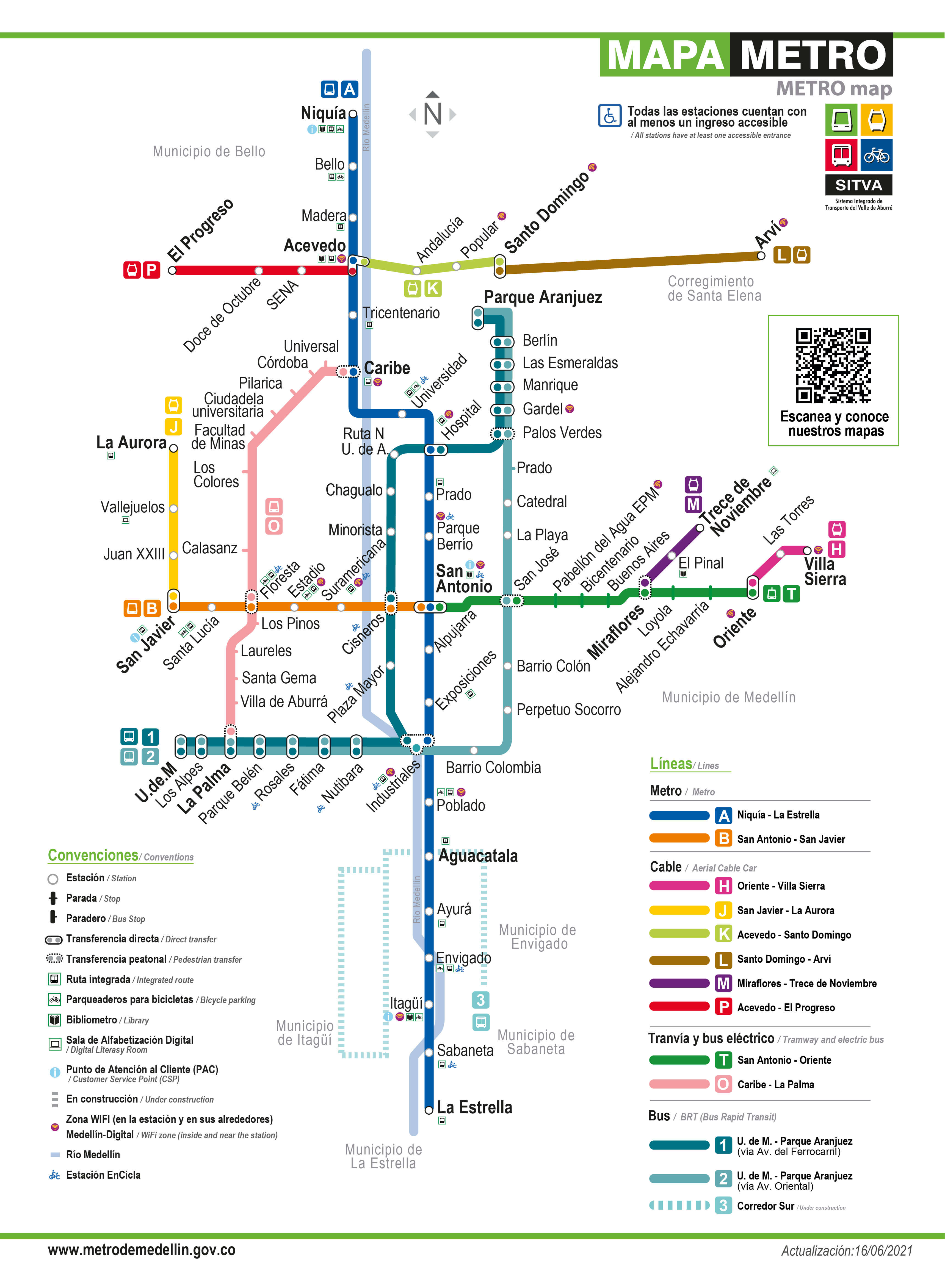
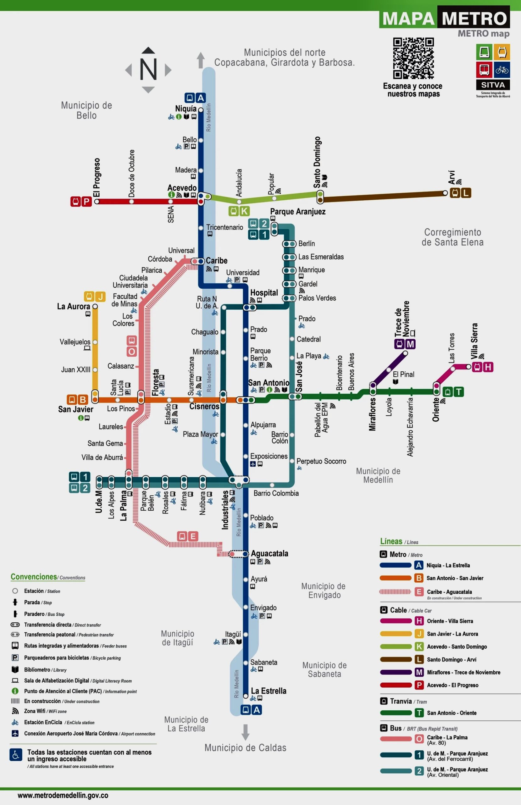
A great city is structured by great public transit, so let’s start by looking at the official map of the Medellín metro, which you’ll find posted in every staton. We’ll refer back to this map throughout the post.
Official 2021 map of the Medellín “Metro”. (The 2026 version has one added complexity which we’ll get to below.) The pale blue north-south line is the river, which is often pleasantly visible from the Line A train.
Although the Medellin Metro map above uses a standard format similar to rapid transit maps worldwide, a quick look reveals the unusual geography and challenges. The pale blue line is the river. Long lines run north-south. East-west lines are shorter, since they run to the steep valley walls.
While many mature cities like Paris have roughly gridded networks that provide multiple ways to make a trip, Medellín’s network is very much trunk-and-feeder, which means it is prone to channeling huge amounts of demand into a single segment or station. Enormous numbers of trips are channeled through the central San Antonio station because so many major corridors meet only there. We’ll return to why this is a problem and what Medellín may have to do as it reaches the limits of this kind of structure.
Diverse Technologies: One “Metro”
If you say the word “metro” in Colombia, people will think of large heavy trains running very frequently along rails, serving large stations. Medellín has two of these, lines A and B. But the brand “Metro de Medellín” wants you to see the whole more-or-less rapid transit network as the “metro” and to care less about what technologies provide each part. This shift from “metro” meaning “rail rapid transit” to “metro” meaning “integrated rapid transit network” has happened in many cities around the world. Still, in nearby Bogotá, if you say “metro” everybody thinks of a train (they are building their first one now.)
Lines A and B meet typical worldwide definitions of a “metro”. These are long heavy rail trains, with overhead electric, fully separated from traffic. They do have human drivers.
But while the north-south Line A is the central axis of the network, the B is quite short, maybe too short. Both are running well below the theoretical maximum frequency that the infrastructure can support, and the A in particular is very, very crowded. (Of course, a great deal of Latin American public transit is crowded, but this line’s crowding is a particular problem because it’s a central axis through which a lot of the city’s demand passes. More on the consequences of this below.)

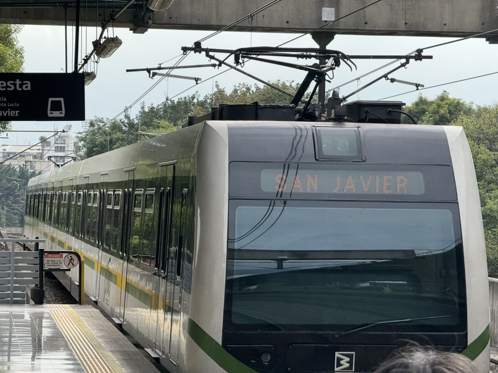
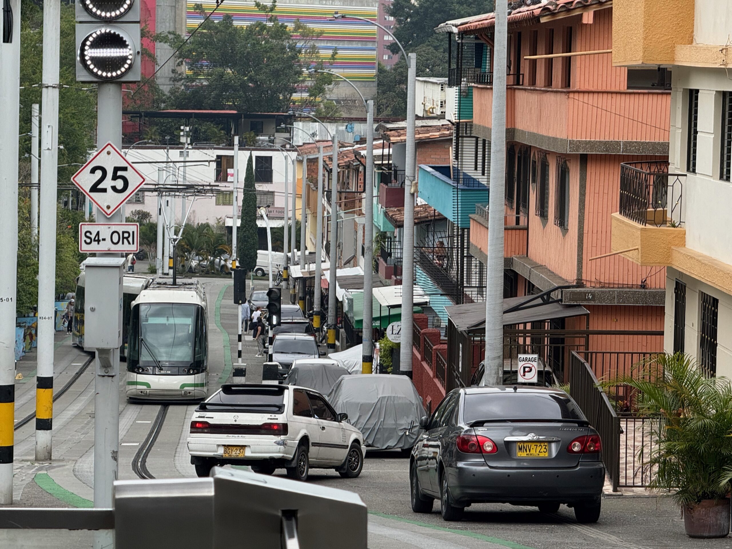
The main eastward axis out of the center is line T, a tram using the single-rail, rubber-tire Translohr technology.

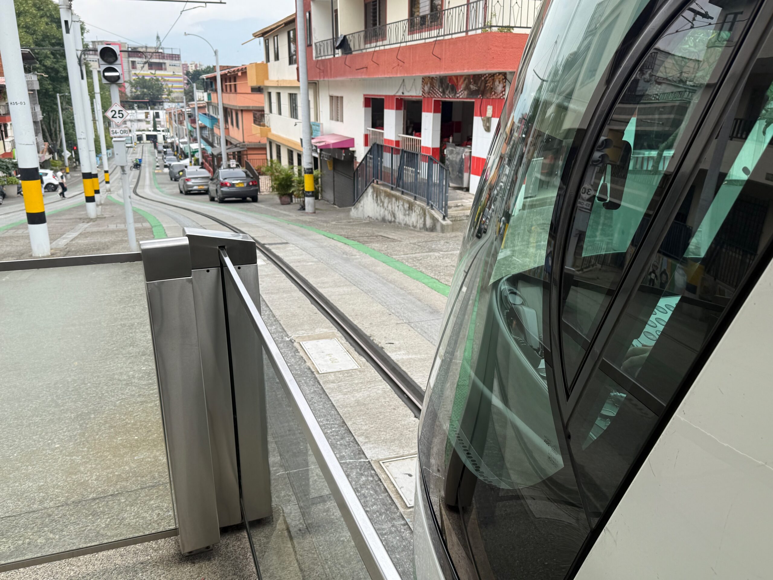
It looks like just another rapid transit line on the map, but it’s much slower and somewhat more prone to disruption. Its street-running right-of-way is theoretically exclusive it’s heavily used by motorbikes and easily blocked by cars that are turning or parking.
This tram causes some anxiety among local transport experts because its inventor has a monopoly on parts and service. It appears to have been chosen for its ability to climb hills, since the maximum grade on this line is a little steeper than what conventional light rail usually handles.
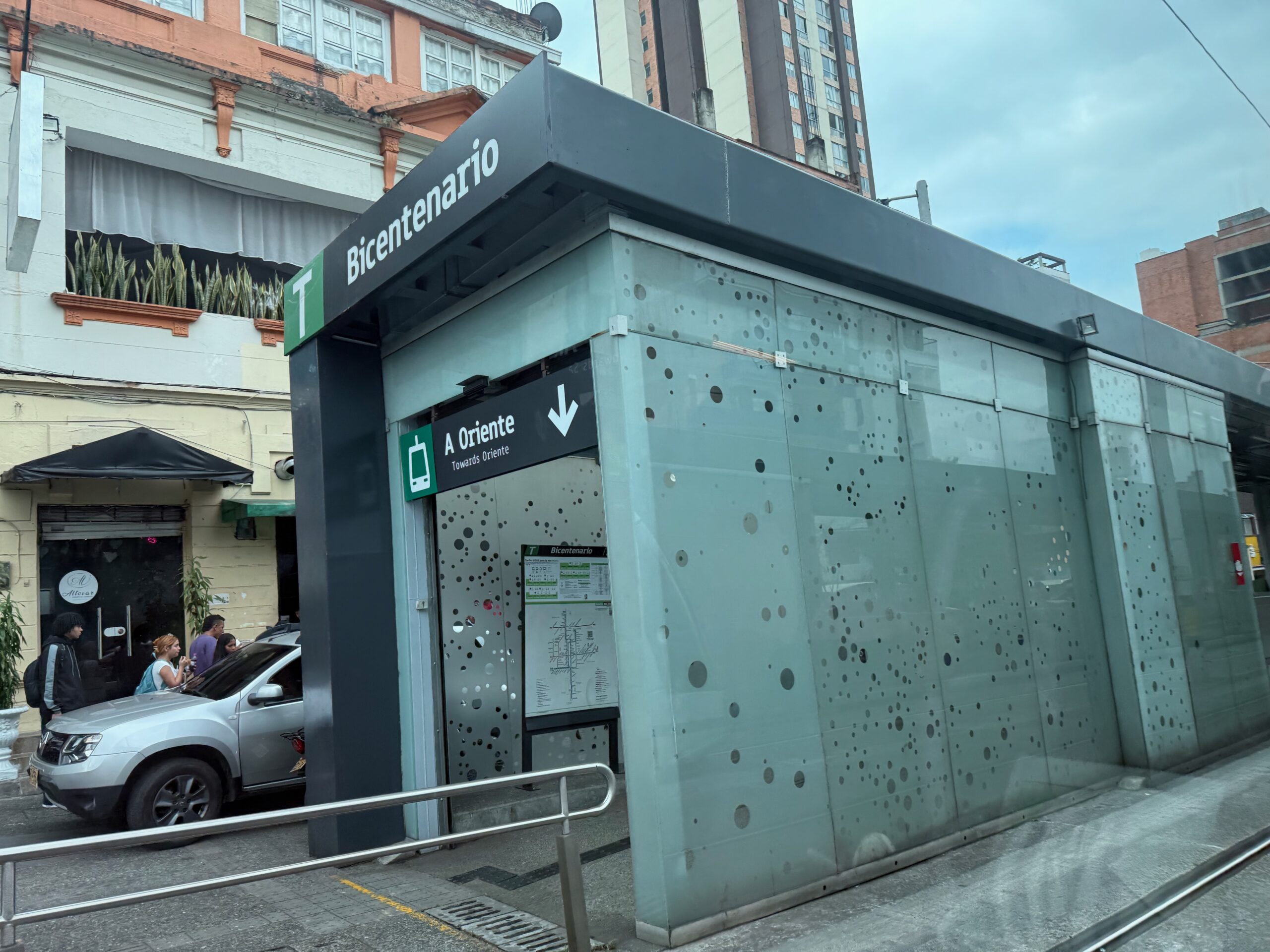
The tram does have paid stations. These are interesting because they have been fitted into a narrow pedestrianized street, taking just one car-width of space. This is a situation where paid stations are often considered impractical.
Then there are two Bus Rapid Transit lines, 1 and 2. These are mostly high-quality, with median paid stations and exclusive lanes. I’ll talk more about them below, because they form the first elements of a grid network structure, running parallel to the overcrowded Line A and helping to relieve it to a degree. The narrow stations, mostly in the medians of wide streets, are paid areas just like the tram stops.
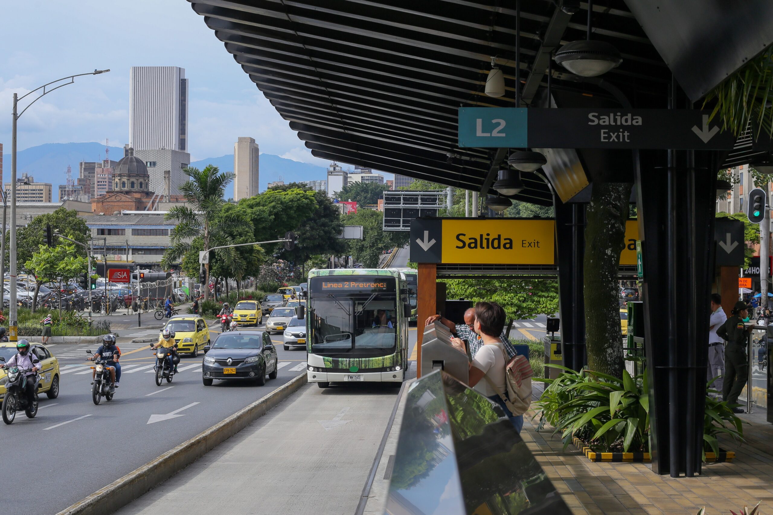
Medellín’s Line 2 Bus Rapid Transit. Note the fully separated stations with low platform doors, just like on the tram.
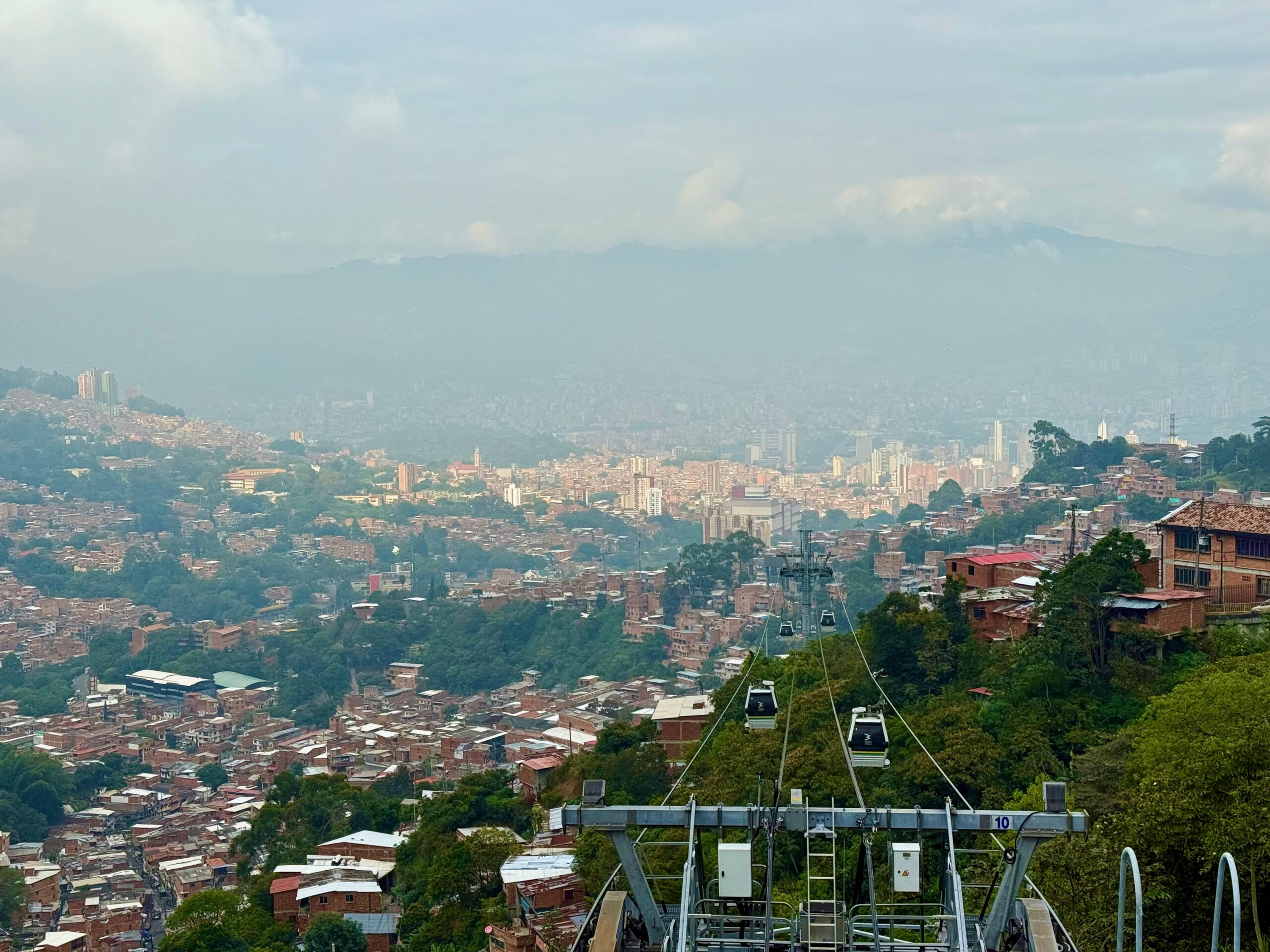
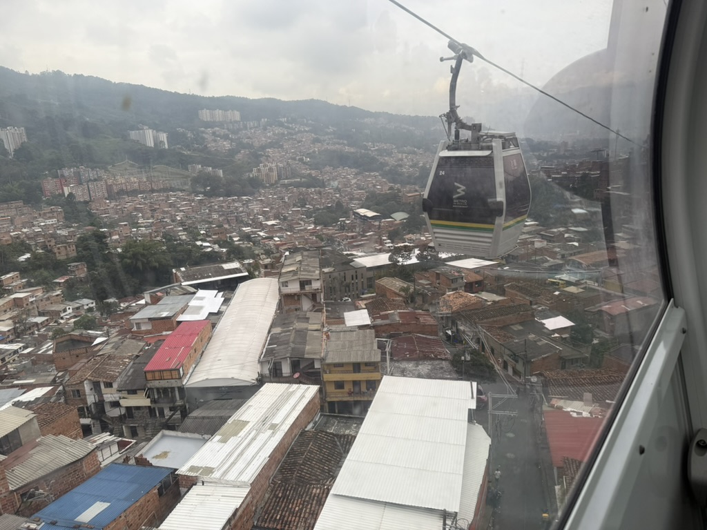
You have probably heard about Medellín’s gondolas. These spectacular services of nearly infinite frequency climb steep hillsides to remote, often low-income neighborhoods. There are six, departing from a station on the rail or tram network and ending in otherwise isolated neighborhoods high in the hills.
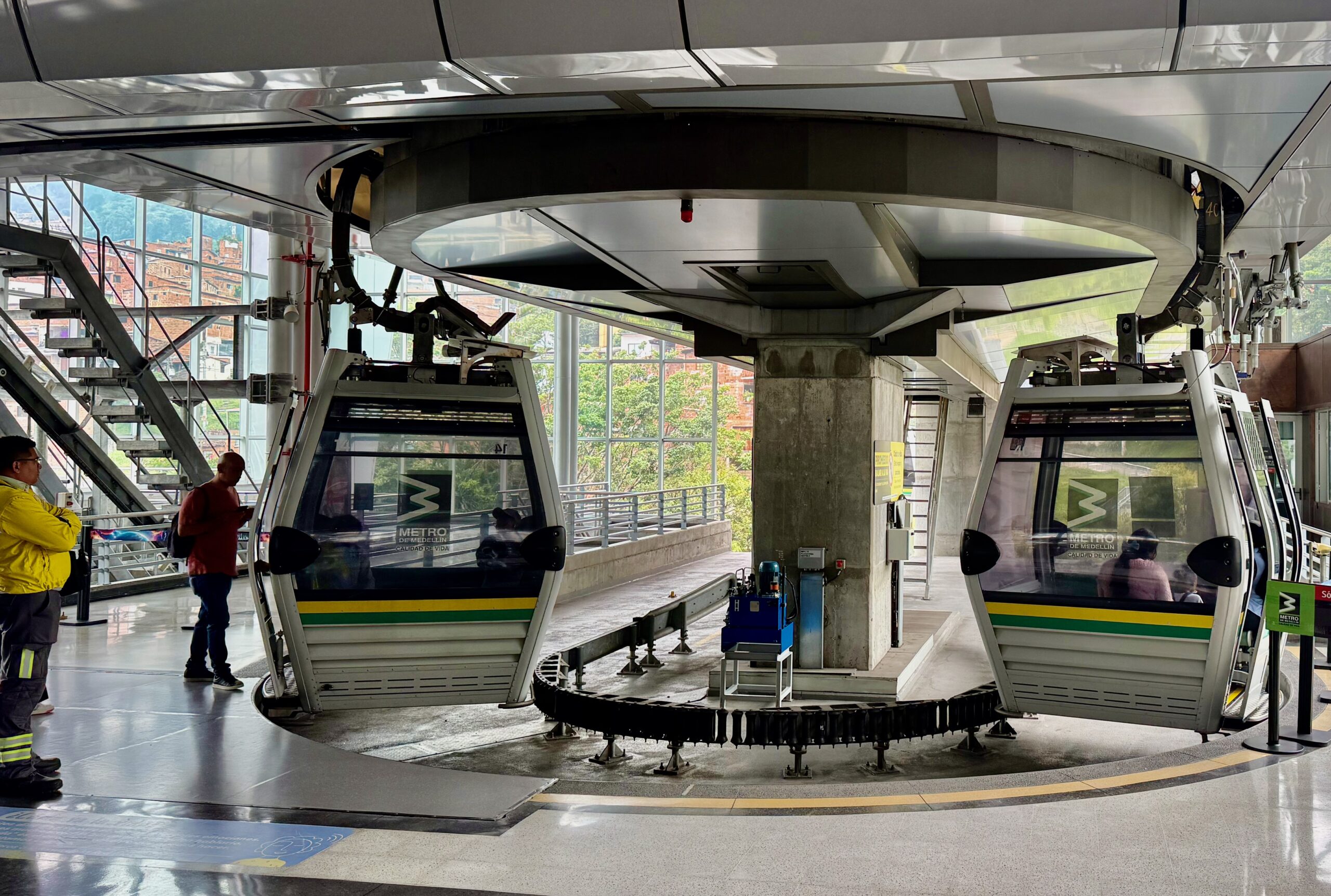
These gondolas are becoming a standard feature of hilly Latin American cities. They have clear tourism value as they soar high above the hillsides with dramatic views. But their real purpose is to bring lifeline access to some of the most neglected parts of the city, informally developed low-income communities that often lack adequate roads. The gondolas dramatically reduced travel times from these areas, expanding access to opportunity and also bringing some tourism.
But wait, there’s one more thing. What’s that Route O on the map, the orbital service on the west side? An “electric bus”? Here it is:
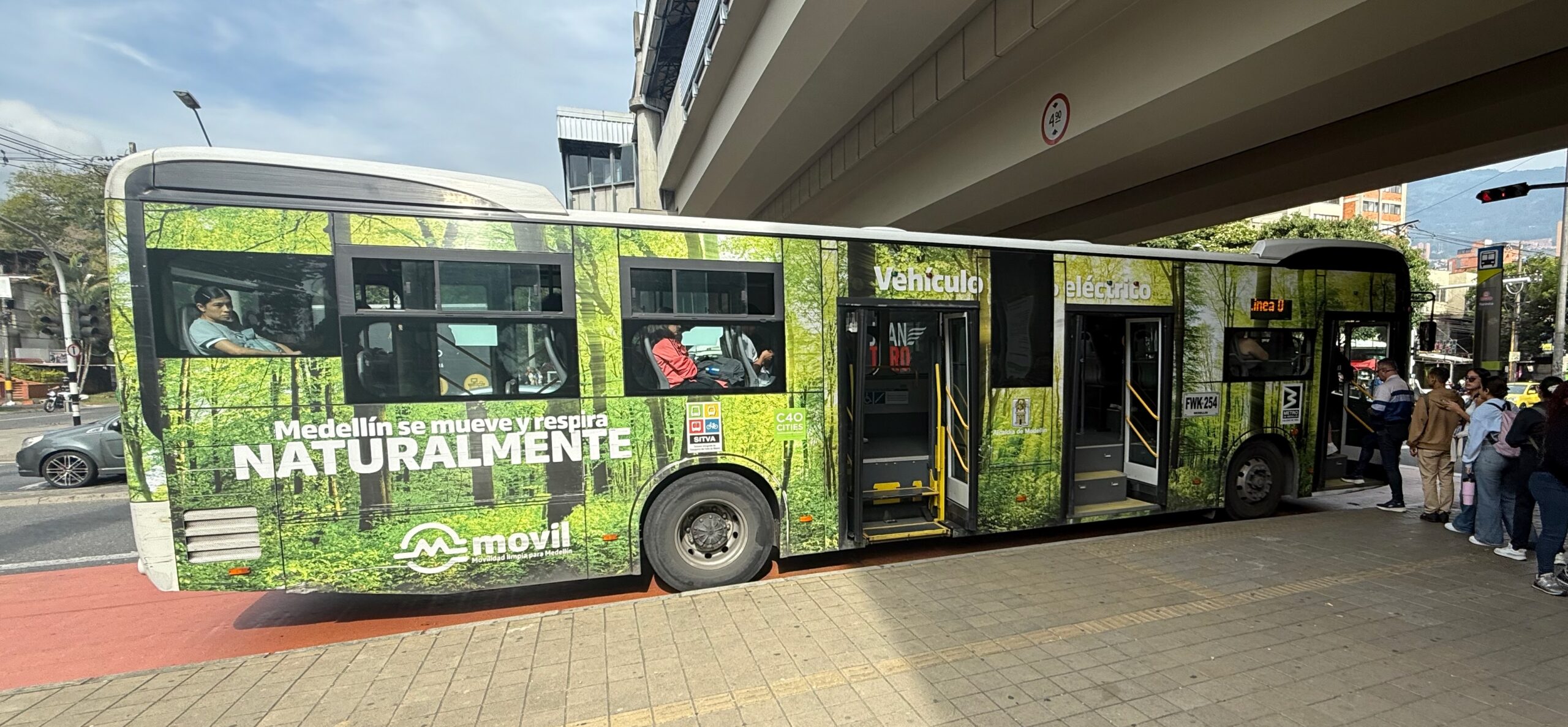
“Medellín moves and breathes naturally”, the text proclaims. But why is this on the “metro” map, with a letter designation? It has nicer shelters than a typical bus stop, but it’s stuck in traffic just like most ordinary buses. This, in fact, is the only line on the map that does not represent service that’s at least designed to be protected from traffic delay.
Yes, there’s a story behind this, something about a grant that came down from Bogotá to buy electric buses, but without enough planning for how to use them or even the proper facilities for them, but let’s brush past that. To put it optimistically, Line O a way of building excitement about the future Line E. The map now posted in the stations has an update on this corridor, in which new Line E, now under construction, will form an orbital arc around the west side of the city, eventually replacing the “Line O” bus. Here’s the newest version of the Metro map, with Line E included as a project under construction.
Line E will be light rail, running largely in median grass track with controlled median stations not much different from those of the tram or BRT.
Is It Good to Have So Many Transit Technologies?
So soon, Medellín will have five rapid transit technologies: heavy rail, tram, gondola, bus rapid transit, and now light rail. When someone wants to tell you how great the transit in a city is, they’ll often refer to how many different transit technologies there are. But really, that just means it’s a great city for transit tourism. The diversity of technologies says nothing about how easy it is to get around the city, and it can be a headache for operations and maintenance.
Only the metro and the gondola are doing things that no other mode can do. The heavy rail metro delivers a capacity that is beyond the reach of any other mode. Gondolas uniquely travel in a way that traverses land without impacting it much; they also climb the steepest slopes and deliver near-infinite frequency by not needing an employee in each car.
But trams, light rail, and bus rapid transit overlap in similar roles. If you could magically turn Medellín’s bus rapid transit into trams or light rail, you’d reduce the diversity of technologies but change nothing about who can go where, when. The opposite is also true: with minor modification, the tram could be replaced by buses that would go a similar speed, stop at the same stations, climb the same slope, and deliver pretty much the same level of speed and reliability. So the fact that there are both trams and bus rapid transit may not be a feature of Medellín so much as a nuisance — again, if you’re focused on the freedom of your residents rather than attracting tourists. If you have fewer technologies, you have more of each one, which allows for all kinds of efficiencies.
For tourism, yes, technological diversity is cool. Just don’t come away from Medellín thinking you know what it’s like for the locals. Because if you care about that, the network form matters more than the technologies!
The Network: Outgrowing the Radial Form
Look again at the map above. Until the bus rapid transit lines 1 and 2 were added, the Medellín metro network was entirely radial. All lines emanated from one point, San Antonio station in the center of the city, or from stations on those lines. In each direction heading outward from San Antonio, the network looked like a tree: a single trunk with branches formed by the gondolas. (The green local feeder buses, which we’ll get to later, would be the twigs and leaves in this metaphor.)
Radial networks are common in a city where there is one overwhelmingly important “downtown” which is centrally located, so that many trips between other points can pass through it without being taken out of the way. Medellín is somewhat like this, but it also has big destinations — hospitals, shopping centers, and so on — scattered throughout the city, and some are not served very well by this structure.
Bus rapid transit lines 1 and 2 break out of that pattern, and new light rail Line E will break out of it still further. These lines are the beginning of a grid pattern, which aims to serve more everywhere to everywhere trips without funneling everyone through a single point. A grid consists of multiple parallel lines, intersecting another set of multiple parallel lines. The result is many points where lines intersect, not just one central hub, and a greater likelihood that your trip will be routed on a reasonably direct L-shaped path with a single transfer.
But this new grid structure that is struggling to be born will be limited by the decisions made when people were thinking radially. Look at the main east west axis across the city. It’s broken in two: Line B (a heavy rail metro) going west and Line T (the Translohr tram) going east. You have to transfer at San Antonio to keep going in the same direction across the city, which is not what you want in a grid. Because the lines are broken, Line B doesn’t touch Line 2 and Line T doesn’t touch Line 1, so if your trip involves this pair of lines (as it well may, because there are big destinations on all of them) you will need to transfer twice instead of once.
In a true grid, you want each line to keep going until it crosses the last intersecting grid line, so that a vast range of anywhere-to-anywhere trips can be made with just a single transfer when you change directions. But Medellín’s rapid transit system will always be a bit limited by the disconnection between Lines B in the west and T in the east.
Now you know why, as I strolled eastward from San Antonio station looking like a tourist, I was idly wondering about a Line B extension in this direction, at least as far as San Jose station where it would touch Line 2. I’m always looking for grids, and when they’re broken, I’m looking at what it would take to repair them. It’s a tough task in this case, because the technologies and urban environments are so different: The B is elevated heavy rail, while the T is a tram running intimately in a narrow street. But once the E is added, running north-south in the west, this problem will become even more irritating, and I won’t be surprised if I see a proposal to extend the B eastward at some point.
Two Bus Networks? Is that Better than One?
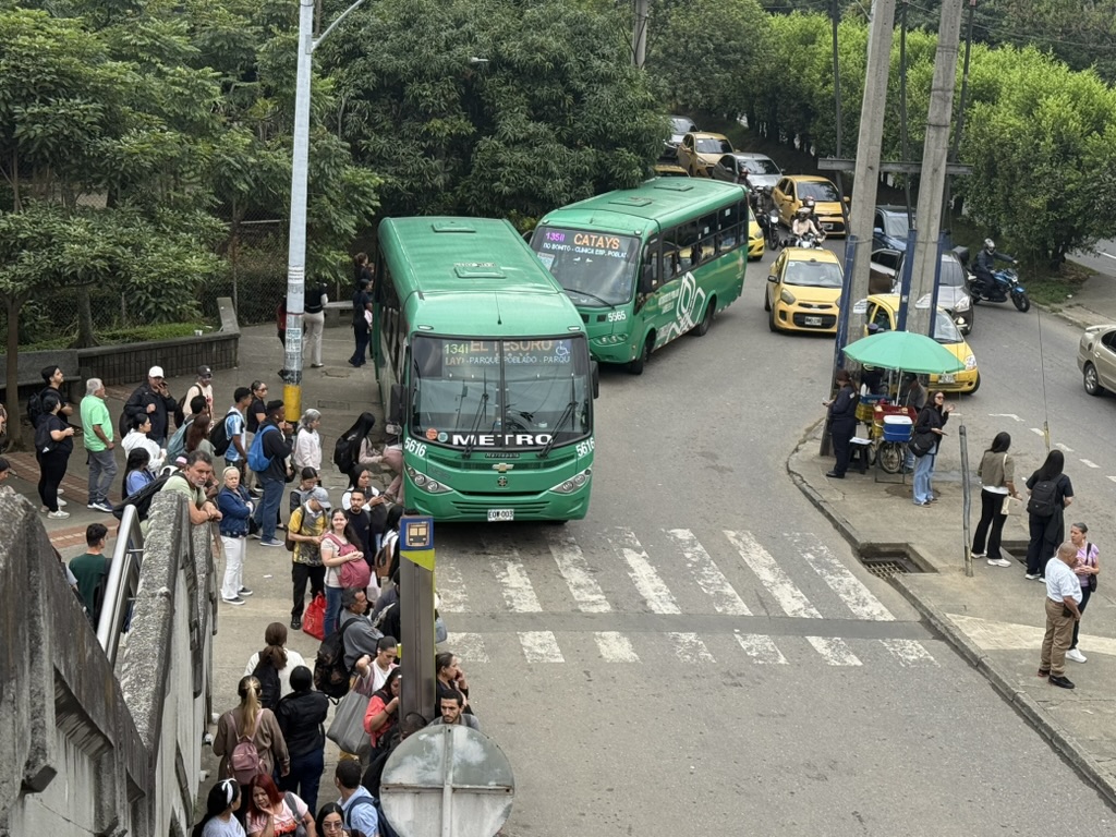
Up to now I’ve talked about the rapid transit network, by which I mean services linking widely spaced stations protected from most traffic delay. But a big share of Medellín’s transit riders don’t use this system. Many use local buses that run mostly in mixed traffic. As in most Latin American cities, the buses are hard to figure out, but the problem is especially bad here because Medellín has two completely different kinds, which are presented separately.
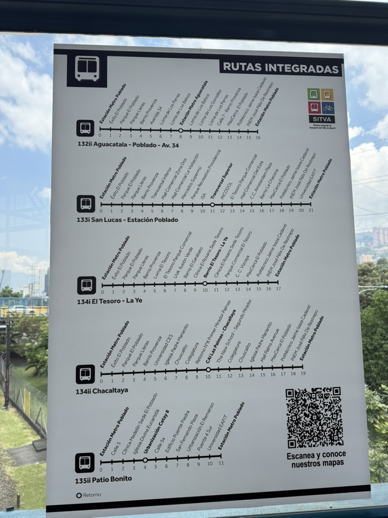
Many of the metro stations have extensive networks of feeders, formally called “integrated routes”. The feeders are funded as part of an integrated network with the metro, and accept the same regional farecard. These small green buses have designated hubs at the stations, and they make a journey outward to cover some part of the local area. These feeders extend the tree metaphor: they are twigs and leaves, bringing the network to a larger area than the trunks and major branches can reach. These lines are mostly fairly short, and while you can use them between any two stops, their design, and their ridership, are overwhelmingly focused on the stations.
Green “integrated routes” (Rutas integradas) feeding the Poblado Metro station.
Simple line maps in the stations advertise these services. The QR code in the lower right takes you to individual maps of each feeder route, though as always I longed for a map that showed all the services together, so I could see how they interact.
But there’s also an older network of buses that radiate from the city center, mostly running mixed with traffic in streets. You can recognize these because the name of an area they serve is usually painted right on the bus, which indicates that there are many companies each with a narrow geographic territory. For example, buses for the southern suburbs of Envigado and Sabaneta run from the city center all the way south, largely duplicating the Metro Line A, before branching out to serve various parts of these suburban cities.
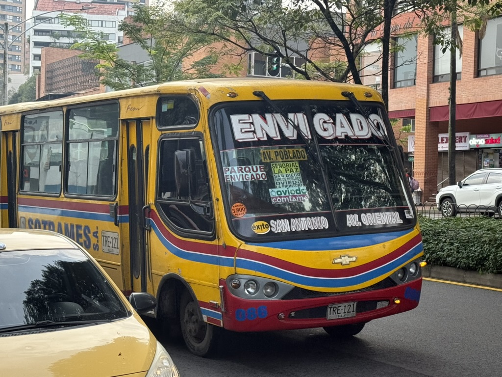
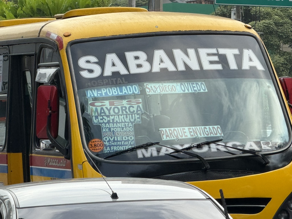
Most of these services do something that you could also do by taking metro and transferring to a green bus. For example, if you’re going from the city center to a point in the southern suburb of Sabaneta, which lies east of the rail line, you can take Metro Line A to the end at La Estrella and then a feeder bus, OR you can take Sabaneta’s yellow bus all the way. In the latter case, you will be spared the nuisance of changing vehicles, but you will also have to sit in traffic most of the way, as the metro trains zoom past you. Of course, the older buses also do things that the metro+feeder network doesn’t do as well. Metro feeders don’t go absolutely everywhere, and there are certainly trips and times of day when the older buses are so much more direct that they’re faster even if they’re stuck in traffic.
Meanwhile, the metro+feeder network is a bit rigid and will have trouble adapting as the network grows more decentralized, because the assumption that the network would always be radial guided the design of the infrastructure. At Poblado station on the A line, for example, two bus hubs are built into the station, one on the east side and one on the west side. You can see feeder buses waiting at both ends, though they look more blue than green from above.
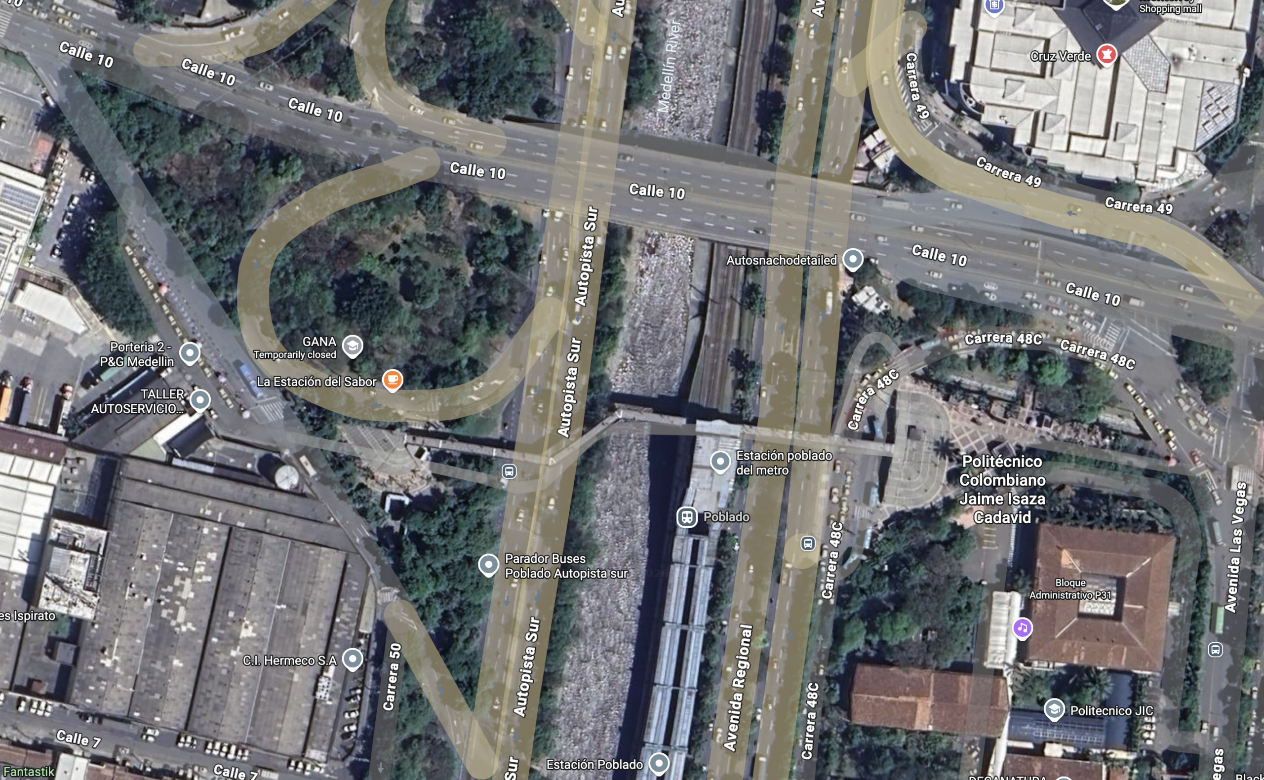
Poblado station on Metro Line A is seen here just to the right of the river. A pedestrian bridge leads east and west to bus hubs. Note how buses can only access the bus hubs by looping. A bus crossing the city east-west on Calle 10, as a grid structure would require, would not be able to stop at the station.
The feeders to the west side of the station serve areas further west, and those on the east side serve areas further east. This is fine when we can imagine everyone is going to the Line A station. But what happens when Line E appears, running north-south further west, and someone to the east of Line A wants to get to it? That’s not going to be easy, because the infrastructure was all designed on the assumption that buses serving the station would always end there. This person coming from east of the station would have to take a green bus from east of the rail line to the station, then walk through the station to the west-side bus hub, and take another green bus to continue. They have the same problem that exists with Lines B and T at San Antonio: They need to transfer to keep going in the same direction, and that means several transfers to complete many likely trips in a grid pattern.
It’s hard to imagine the infrastructure that would solve this problem. Everything about this area is designed on the principle that the sides will be fed to the spine but never need to cross it. And yet, Line E will soon appear, and this problem will appear with it.
Conclusion
If I were advising Medellín, I’d try to create a workspace where we could at least draw and analyze what a fully integrated network might look like, and what it could achieve, so that people could see how much improvement would be possible without increasing operating subsidy. I can imagine the complexities we’d encounter. For example, Metro Line A is crowded, and probably couldn’t handle everyone who now rides the buses that duplicate it. But the line itself has spare capacity: with more trains, it could run more frequently, and of course you could consider automation to get the frequency even higher if it came to that. So I don’t pretend it would be easy. But I know we would discover possibilities that nobody has considered, because we always do. Medellín is going to outgrow its historic transit network, and despite all its cool technologies, the next big improvement in access to opportunity can only arise from making the abundant bus services more effective. Eventually, that will mean one network of services that all work together.
Would it be practical to extend the B metro line further east, or is the geography/geology a problem?
The first segment to San Jose station would be a big structure hanging over narrow streets. Physically possible but impactful, though the city has shown a tolerance for heavy elevated structures through the core. Beyond San Jose probably not. You could go underground with metro but if the tram stopped functioning you could also just replace it with Bus Rapid Transit.
With Translohrs, it’s not a matter of “if” but “when” – they’ve been ripped out and replaced with BRT or real trams repeatedly for a reason
It looks quite plausible to me. You wouldn’t follow the tram route — you would just keep going east. The pillars end here (https://maps.app.goo.gl/i23QZTsuHbzx8tgY8) so you would continue on Calle 46 and Calle 47. It seems a little tight in places but not too bad.
As Jarrett mentioned, after that the road narrows: https://maps.app.goo.gl/HjLEUhRToJN4W1WL8. One alternative to going underground would be to turn north there and then dogleg to head east, hopefully to Miraflores. So basically this: https://maps.app.goo.gl/L77Ki8Zcu85esHFB6. Not trivial but I think it would work. Even if it only got part way it would likely help a lot. Either way I would keep the tram. It would provide additional value (since the elevated line would be different).
Another issue with Medellín’s transit is the stations themselves along much of the A line trunk. Taking Poblado as an example, the station is quite nice but actually really isolated from the surrounding areas. To reach the station by foot, it’s normal to dodge traffic running across highly-trafficked roads, often with poor signage and pedestrian safety features.
While there is significant overlap, trams and buses are not 1:1. The Translohr STE5 vehicles are 39 m long, while buses can be 25-27 m. So you will need a higher freqency. It will then depend of the case whether the stations and intersections can handle this within the available space.