Author Archive | Jarrett

On Flying Cars

A journalist asked my opinion about flying cars. I wrote this.  Please tell me where I’m wrong.

For every technology pitch, you must ask not just “what is this like from the inside?” but also “what is it like from the outside?”  All vehicle technologies are sold based on how cool or useful it will be to ride them.  And most of these pitches do not want you think about what it will be like to be outside of them, or to share a city with them.

The issues with air taxis are obvious.  Even if they are much quieter than helicopters, they will introduce a new type level of noise to the city, anywhere near where they takeoff and land.  Their presence overhead in any numbers will have physical and emotional effects on the population.  They will introduce entirely new kinds of accidents that make everyone fearful of the space above them.  And in the end, by allowing elites to opt out of the transportation problems that everybody else in the city is having, they will encourage elite disinterest in solving those problems.

They will be cool to ride, though.


A Fine New Guide for Transit Activists

Steven Higashide, Better Buses, Better Cities: How to Plan, Run, and Win the Fight for Effective Transit. Island Press, 2019.

Why are American cities finally taking buses seriously?  Because, as Churchill famously said, “Americans will do the right thing, after they’ve exhausted all the alternatives.”

I’ve been following transit in America for 35 years, and working in the field for 25. During that time, cities have growh frustrating to get around in, with dire consequences for people’s access to opportunity. But throughout that time powerful people have always been telling me that buses just don’t matter. Development interests cared only about rail or ferries. Technology marketers have always shiften the conversation to new patented things, of which some are useful but many are tragic distractions.  To the extent that buses have mattered to the powerful, it’s often been as a social service — a charity that they give pennies to out of pity but whose functionality they barely care about.

And that’s not even to mention the active hostility to bus service that transit planners encounter daily: the shopping mall or hospital that refuses to let a bus get anywhere near the building, the communities that want buses out, the urban businesses who think that motorists are the only customers who matter.

But having exhausted all the alternatives, American cities are finally rediscovering this essential tool. No remotely functional city in the world lacks a transit system, and the bus is always a critical layer – the thing that goes to all the high-demand places that rail can’t go.  As we enter the inevitable hangover from the mid-2010s sugar-rush of tech boosterism, people are finally doing the math to see why, for a city to function for everyone, buses simply must be allowed to succeed.

Steven Higashide has written a great little book charting the current and incipient bus revolution.  In a skillful balance of facts and stories, Higashide explores what successful bus services look like, and how to overcome the barriers to bus service reform. He interviews the architects of some of the most impressive achievements, and also delves well into the deep challenge of equity and public engagement.

Do I have quibbles?  My only serious one is that I wish the book were clearer about where activists should direct their constructive rage.  US transit agencies are less powerful than they appear and are often not the source of the biggest problems. Much of what they do is defined by their poverty and by the great mass of regulations and labor contracts that form the boundaries of their world.

At times Higashide understates the danger of telling transit agencies to do so many things that everything they do suffers from lack of focus.  Transit agencies desperately need to focus on designing and running good transit systems.  Demanding they take on other battles often comes at a cost to that core business, by dividing staff and elected attention.

For example, Higashide suggests that transit agencies lead on pedestrian infrastructure around stops, a massive task that falls in the city (and sometimes state) role in managing streets. Cities must be pressured to adopt their own transit goals that lead to those kinds of investments, as leading ones like Seattle have done for years.  Just because transit is connected to everything doesn’t mean transit agencies should have to solve every related problem with their own meager budget, as they are often told to do. That just leads to ever-lousier bus service.

But this book is so good in so many ways that I don’t mind disagreeing with it here and there. The messages are critically important. The writing is lively and fun.  You can read the whole thing in a couple of hours, and it’s short and logical chapters support easy snacking.  It’s a great tool for giving you hope, and focus. Buy it, read it, give it to people who need it. It will make a difference.


10 Years of Human Transit

This blog is 10 years old!  Please help celebrate by perusing the new Basics page!  There, you’ll find links to all the articles I’ve done that are likely to be most useful to people thinking about transit all over the world.  (If you think I’ve missed one, let me know!)

The blog was started by a frustrated American transit planner living in Australia.  Its first two years gestated the book Human Transit (introduction here) which in turn helped create our firm, Jarrett Walker & Associates, which provides transit planning and policy advice.

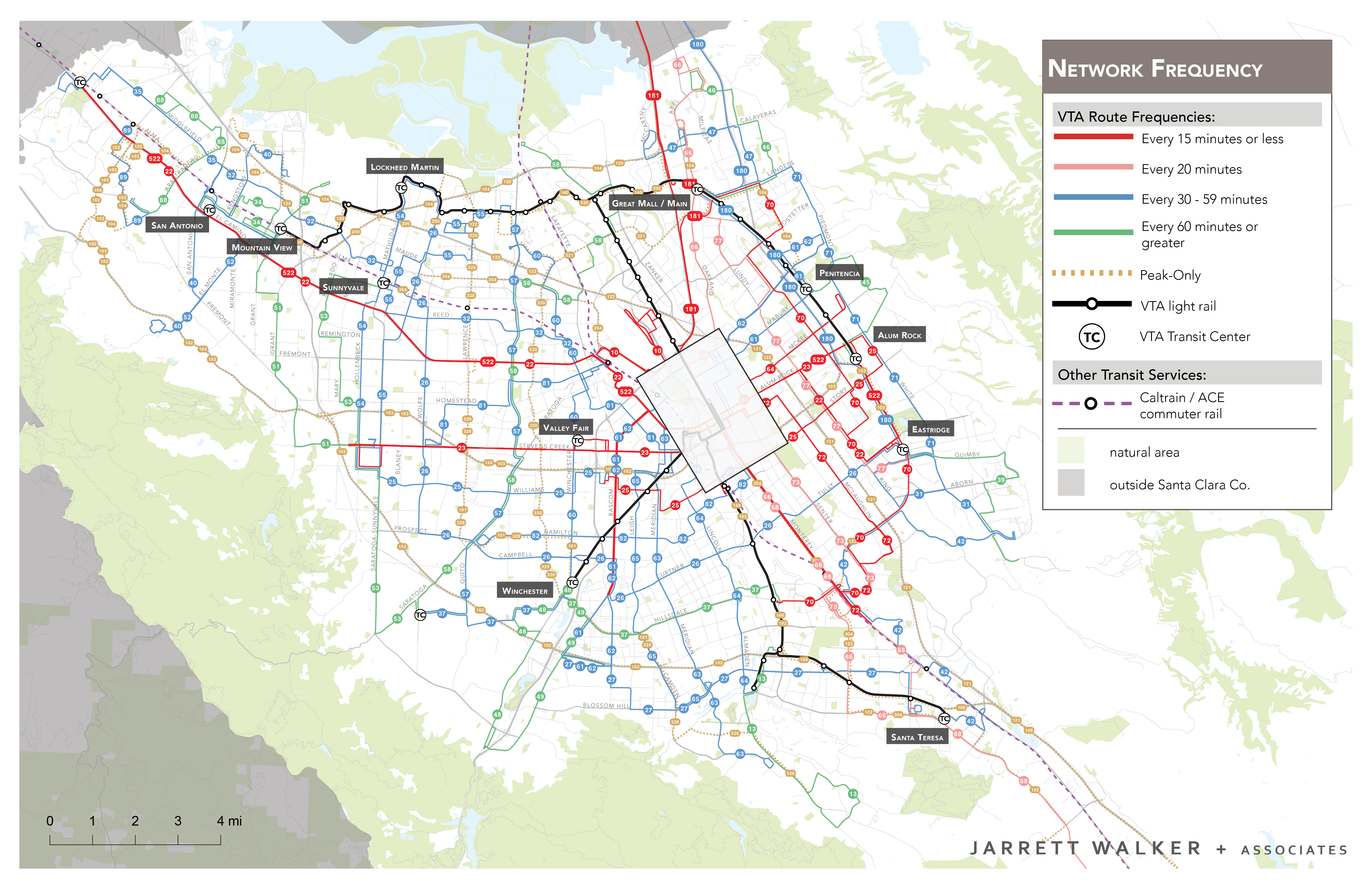
We’re 13 people now, with offices on both coasts of the US.  We’re proud of our recent track record of network redesigns.  Ridership is up as a result of plans we (or I) worked on in Houston, Auckland (NZ), Columbus and Richmond.  Our redesign for San Jose and Silicon Valley (VTA) goes live soon.  We’re currently doing similar work in Dublin (Ireland), Kansas City, Miami, Cleveland, and (just starting!) Dallas.  We’re also proud of our record in many smaller cities, from Anchorage to West Palm Beach.  And we’ve had some more distant adventures, including advising on the massive Magistral redesign of buses in central Moscow and a sojourn analyzing the network in chilly but friendly Reykjavik.

Some data for fun:  This is the 1225th post and the blog has gathered about 20,000 non-spam comments, many of which have started great conversations and generally made me smarter.  The top countries by readership over the last 3 years are, not surprisingly:

  1. USA
  2. Canada
  3. Australia
  4. UK
  5. India
  6. Ireland

But the top countries by readership per capita (readership divided by population) are

  1. Ireland
  2. New Zealand
  3. Canada
  4. Australia
  5. Iceland
  6. USA

… all places I’ve worked! Not all of this is honest curiosity, of course.  A few people have been looking for things to attack me for. But that’s fine.  No such thing as bad publicity.

You may have noticed the rate of new articles slowing down, and especially this year.   I will certainly never return to the rate of posting of the early days, when all of my surplus energy went into the blog, but I’ll keep writing useful things as long as enough people keep reading them.

How to keep up?

  • You can subscribe using FeedBurner.  (In the bar under the banner above, it’s the symbol to the left of the “search” (magnifying glass) symbol.)  If you’ll click that you’ll see an option to get every post emailed to you.
  • Follow me on Twitter, @humantransit!  There you’ll find every post announced there, and you’ll also get a lot of other commentary.

I can’t say how grateful I am for all of the feedback over the last 10 years.  I look forward to continuing the conversation.


What is “Microtransit” For?

In last year’s “microtransit week” series, I challenged the widely promoted notion that “new” flexible transit models, where the route of a vehicle varies according to who requests it, are transforming the nature of transit, and that transit agencies should be focusing a lot of energy on figuring out how to use these exciting tools. In this piece, I address a more practical question:  In what cases, and for what purposes, should flexible transit be considered as part of a transit network?

For clickbait purposes I used “microtransit” in the headline, but now that I have your attention I’ll use flexible transit, since it seems to be the most descriptive and least misleading term.  Flexible transit means any transit service where the route varies according to who requests it.  As such it’s the opposite of fixed transit or fixed routes.  But the common terms demand responsive transit, on-demand transit and “microtransit” mean the same thing.

This article is specifically about flexible transit offered as part of a publicly-funded transit network.  There may be all kinds of private-sector markets — paid for by institutions or by riders at market-rate fares — which are not my subject here.  The question here is what kind of service taxpayers should pay for.

As I reviewed in the series, the mathematical and historical facts are that:

  • Flexible transit is an old idea, and has long been in use throughout the world.  No living person should be claiming to have invented it.  The only new innovation is the software and communications tools for summoning and dispatching service. You can now summon service on relatively short notice, compared to old phone-based and manually dispatched systems that only guaranteed you service if you called the day before.
  • Flexible transit is extremely inefficient compared to fixed route transit, for reasons that no communications technology will change. Flexible services meander in order to stop at each person’s destination. Meandering consumes more time than running straight, and it’s less likely to be useful to people riding through.  Fixed routes are more efficient because customers walk to the route and gather at a few stops, so that the transit vehicle can go in a relatively straight line that more people are likely to find useful.
  • How inefficient are flexible services? While there are some rare exceptions in rare situations, few carry more than 4 customers per driver hour.  In suburban settings, fixed route buses rarely get less than 10, and frequent fixed route services usually do better than 20.
  • There is no particular efficiency in the fact that flexible transit vehicles are smaller than most fixed route buses, because operating cost is mostly labor. You can of course create savings by paying drivers less than transit agencies do, but if a particular flexible service achieves a low cost per rider, that’s not because it’s flexible. It’s because you’re paying the driver less.
  • The only places where flexible service is the most efficient way to achieve ridership are places with very, very low transit demand, like small towns, rural areas, and the lowest-density suburbs.  If there is no demand for fixed routes that could carry more than 4 boardings per driver hour, you might as well run flexible.
  • Therefore, except in very low demand places, flexible transit makes sense only if ridership is not the primary goal of a service.  If your goal is coverage, however, they may still have a role.

All transit agencies must balance the competing goals of ridership and coverageCoverage means “providing access to transit regardless of whether many people use it.” A typical measurement of coverage is “___% of population is within ___ distance of transit service.”  Coverage goals arise from popular principles such as “leave nobody behind,” “be there for people who need us,” and “provide a ‘fair share’ of service in every city or electoral district.”  They are important goals to many people, but they tend to conflict with ridership goals, because they require running lots of service that has no hope of every being highly productive in ridership terms.  (For a fuller explanation of this critical concept, see here.)

To provide clear direction to planning, we always encourage transit agencies to form a clear policy on how much of their resources should be set aside for service whose goal is a high coverage, not high ridership.

Once you have decided to invest some of your resources in coverage service, and know that ridership is not the point, flexible service may have a role.  That’s because if your goal is take credit for bringing transit close to many homes, it’s sometimes more efficient to do that without actually near every home every hour.

In a great deal of American suburban development, you’ll find things like this:

This series of peninsulas and islands on the south edge of Savannah, Georgia is covered with very low-density residential development, in which entire neighborhoods are effectively cul-de-sacs.  A fixed route that tried to cover this area would have to go out each peninsula, turn around, and come back. In fact, there’s a bus route that tries to do that.

Savannah’s Route 20. Source: Chatham Area Transit.

It’s a rare example of a route who’s ridership is so low that flexible service might do better, and it’s not hard to see why.  Few people would be willing to ride through all these loops.

A flexible service could service this area with fewer driver hours.  To do this, it would allow enough time to go to perhaps half of the peninsulas in each hour, but would take credit for covering all of them.  That way, it would provide the lifeline transit access that is coverage service’s goal.  If enough people lived in landscapes like this, then this tool could help an agency satisfy a target like “90% of residents are within 1/2 mile of service.”

Flexible service isn’t always the right coverage tool.  There are many areas where density is too low to attract ridership, but where the street network puts most homes and destinations within a reasonable walk of through-streets.  Fixed routes can cover those areas quite efficiently, even when meeting a coverage goal.  But flexible services do have a place in the coverage toolbox.

However, contrary to almost all “microtransit” marketing, ridership is the death of flexible service.  Suppose that a flexible service on these peninsulas was so attractive that many people began calling it.  Then the flexible route van would be expected to go to every peninsula every hour, which is impossible. So more vans would have to be added, still at a very high cost/rider.  This process would devour the limited coverage budgets of most agencies, and if those agencies haven’t established a clear limit on what they’ll spend on coverage service, this process can start threatening high-ridership service.  At that point, someone should ask: If you end up deleting a bus carrying 30 people/hour so that you can run a van for 3 people/hour, aren’t you basically telling 27 people/hour to buy cars?

So attracting many riders to flexible services is the last thing a transit agency should want to do.  In fact, when flexible services become too popular, they have to be turned back into fixed routes.  Imagine that a flexible service covering the area above got so popular that you needed three vans to run it.  At that point you might as well just run a separate fixed route for each peninsula, at which point each one could be reasonably straight.  Still, though, three buses may be more than this particular area deserves, when you look at the total budget for coverage services and spread it over the whole region.  So if you really want to claim that you’ve covered all of these peninsulas, you want flexible service, but you also want to take every possible step to keep ridership down.

For this reason, too, flexible transit must avoid being more convenient than fixed routes.  It may need to have a higher fare, and it certainly shouldn’t offer service “to your door.” If the goal is coverage to areas where fixed routes don’t work, like these Savannah peninsulas, then you should provide the same quality of service that fixed routes do, which is to say, service to a point within a short walk of your house. This keeps the van out of cul-de-sacs and gravel roads, allows it to follow a somewhat straighter path, and thus allows it cover more area in an hour, which is the whole point.

So most discussion of flexible services or “microtransit” is missing the point.  The Eno Foundation report, for example, went to great length to sound optimistic about pilots that were achieving three passengers per service hour – a worse-than-dismal performance by fixed route standards.  Flexible service will never be justifiable if the goal is ridership, because if ridership were the goal you wouldn’t serve places like these low-density peninsulas at all. Only if the goal is coverage do these services ever make sense, so only in that context does flexible service appear as a possible solution.

Unfortunately, plenty of “microtransit” marketing is still sowing confusion about this.  Transloc promises to “solve the frequency-coverage dilemma,”[1] which is dangerous nonsense.  “Microtransit” is a kind of coverage service, not a way to avoid having to think about how much service to devote to coverage goals.

Flexible service will never compete with fixed route on ridership grounds, so it should stop pretending that it can.  Market the service as what it is.  It’s one tool for providing lifeline access to hard-to-serve areas, where availability, not ridership, is the point.


[1] Transloc page https://transloc.com/microtransit-ondemand-software/ as of August 28, 2019.

Linking US Small Cities and Towns: Time for State Leadership

When I was a boy, the US had a robust network of intercity commercial transit services, run by Greyhound and Trailways.  These services didn’t just link the biggest cities.  They also linked smaller towns and cities, too small or too close for airlines to serve.

In my home state of Oregon, for example,  the network looked like this.

Oregon private sector intercity bus services in 1976. Source: Bill Vandervoort chicagorailfan.com.


We often rode Greyhound (blue) or Trailways (red) from Portland to the then-small towns of Central Oregon (150 miles) or on one one of four routes out to towns on the coast, 60-100 miles away.

Almost all of those services are gone.  Private intercity bus companies, including new players like Megabus, stick to linking big cities.  All that remains is a minimal state-funded service called Point, one or two trips a day, mostly to feed Amtrak.

Transit agencies have done their best, but the US habit of organizing transit in county-level agencies means that many obvious services don’t exist.  Consider Eugene, Oregon (metro population about 250,000 with a big university).  It has a city bus line (4 trips/day) to the small mountain town of McKenzie Bridge, 53 miles away, but there’s no line to go the 41 miles to Corvallis (population 58,000 with the state’s other major university).  Why? McKenzie Bridge happens to be in the same county, and Corvallis in a different one.

Australia has similar geography to many US states but features state control of all public transit.  Local governments, including the rural ones that are comparable to US counties, have little role.  This arrangement has big downsides, but it does mean that state government actively organizes the long transit lines linking small cities, often with rail but extended as needed with buses.  As a result, there’s a viable public transit option for intertown travel in many parts of Austraila.

We have worked for several county and municipal transit agencies on addressing this problem. All are doing their best. Some have formed interesting partnerships, such Oregon’s NW Connector, to extend service a ways into adjacent counties and present multi-county networks in an integrated way.  But the mission of a county or municipal agency just does not let them run the long, continuous routes that make sense for these markets.

So bravo to the State of Colorado for a new initiative to expand state-funded service for obviously intercity links across their state.  Oregon is in the early stages of developing more such services, thanks to a new statewide funding source.  What is your state doing in this regard?

Miami: The Better Bus Project Goes Public

We’re delighted to announce the release of our analysis of the bus network of Miami-Dade County, the Better Bus Project Choices Report.  The report reviews existing services, identifies possible paths for improvement, and also points to difficult choices that policymakers need to think about.  Here’s the Miami Herald‘s coverage.

We’ve worked on a lot of bus network redesigns, but the Miami-Dade Better Bus Project is unusual in a number of interesting ways.

Most remarkably, the project is led not by the transit agency, but by a well-resourced and well-respected advocacy group, the Transit Alliance.  These folks brokered a deal where they would manage a study on behalf of both Miami-Dade Transit and several of the key cities.  They are handling all of the public outreach and government relations, leaving us to just do the planning behind the scenes.

The role of the cities is also unusual.  Many cities in the county run their own “trolley” services, which offer small buses, free fares, but often routes that duplicate what the countywide Miami-Dade Transit network does.  This happens in other metro areas, but in this project we some of the key cities at the table, trying to come up with the best solution for the city andthe region.

Less unusual, sadly, is now thinly the service is spread.  Here’s a bit of the network map for the dense core of the region.

And the legend:

Most effective transit systems have some kind of frequent grid, where many intersecting lines run at least every 15 minutes all day.   Houston’s, which we helped design, looks roughly like this:

The key idea of a frequent grid is that wherever red lines cross it’s easy to change buses to go a different direction, and that’s the key to being able to get to lots of places in a reasonable amount of time.

You’ll find extensive frequent grids in a number of gridded cities, including not just big cities like Los Angeles and Chicago but also in Houston, Portland, Phoenix and even Tucson.

But Miami-Dade, which is equally dense and equally gridded, has essentially no frequent grid.  There are grid lines, but most run every 20-30 minutes, not enough for connections to be easy.  Only in Miami Beach will you find the intensive frequent service that means transit is there whenever you need it.

So that’s one issue we’ll be looking at.  Others raised by the choices report include:

  • What’s the ideal division of labor between county transit and municipal services?
  • Is there too much peak service and not enough all-day service?  Overall, productivity (ridership / service quantity) is lower during peak hours than midday, which suggests that might be the case.
  • And biggest of all, how should the region balance the competing goals of ridership and coverage?

In the next round of the project, we’ll present illustrations of how the network might look if the region gave a higher priority to ridership, or if it gave a higher priority toward coverage.  As always, the first will have fewer and more frequent lines, but less service to some low-demand places, while the coverage network will go everywhere that people expect service, at the expense of lower frequencies.  As always, we’ll encourage a public conversation about this unavoidable question.

So if you know anyone in Miami-Dade County, send them to the project website to explore and express their views.  Encourage them to peruse the Choices Report. And if you’re interested in reforming bus networks in general, this one will be an interesting example.


Portland: Facing the East-West Chokepoint

That red line (and the adjacent blue line that’s hard to see) is the east-west spine of Portland’s transit system. On the west, it is one of just two direct paths (street or transit) across the hills linking downtown and the the “Silicon Forest” suburbs to the west. But the slow operations across downtown makes this line much less useful than it looks. Credit: Travel Portland.

In 1986, Portland opened one of the first modern light rail lines in the US, the beginning of a light rail renaissance that built networks in mid-sized cities across the country. It was nice to be a leader — we’re used to that in Portland — but it also means that everyone has learned from our mistakes, while Portland still has to live with them.

Perhaps “mistake” is too strong a word, but the priorities of the early light rail designers certainly aren’t the priorities today.  Planners of the 1970s (when I was an enthusiastic teenage transit geek) confronted a city whose downtown consisted mostly of surface parking while prosperity fled to the suburbs.  Their top priority wasn’t even getting people to downtown.  It was making downtown a place worth going.

So they built a line that rushes into the city from the eastern suburbs, but then creeps across the inner city, making lots of stops for a net speed under 7 miles/hour.  For a while that was fine.  All those stations meant lots of development sites right next to the line, and downtown grew and prospered.

Today, the success at revitalizing downtown has created an opposite set of problems.  Downtown and the surrounding neighborhoods are so successful that working people can’t afford to live there.  Low income people are being pushed out to places where they face longer commutes.  Most important, the line now continues west out of downtown to serve the “Silicon Forest” suburbs to the west, so that it runs across downtown, not just into it.  Meanwhile, the development that the slow downtown segment was supposed to stimulate is largely done.

So the downtown segment of the line is becoming more of a barrier than a resource.

Transit in Portland benefits enormously from chokepoint geography.  Between the inner city and the western suburbs, there is a wall of hills pierced by one gridlocked freeway, one parallel arterial, and a light rail line.  This rail segment has prospered because the driving alternatives are terrible.

As always, chokepoint geography means: It’s worth spending a lot of money improving transit here, because so many trips, between so many places, go through this point.  A regional inbalance of jobs and housing (more jobs in the west, more housing in the east) has create a huge east-west travel demand right through this ch0kepoint.  The hills are still a barrier for drivers, but for transit the barrier is the slow downtown streets, and the 1970s assumption that the train needs to stop near every building.

As if the slow operations weren’t bad enough, there’s also a problem of capacity.  Portland’s adorable little 200-foot blocks, rightly credited with giving downtown such a human scale, limit the train lengths to 2 cars as long as they run on the surface.  The city is too big now, and its transit needs too dire, for such tiny trains to do the job.

The problem is being attacked at several scales.  The transit agency is gingerly suggesting that a few stations should be closed. Stations on the downtown segment are as close as 350 feet — far too close for bus stops, let alone rail stations.  (The newer north-south light rail line, whose designers learned from the mistake, has station spacing closer to 1000 feet.  Unfortunately, it is the east-west line that extends furthest into the suburbs and therefore serves the most people.)

But the problem is so big, and obstructs so much access to opportunity across the region, that it won’t be solved just with half measures. A long overdue study is looking at the complex of capacity problems, and while it’s looked at some half-measures, the only thing that solves all the problems is a new segment of subway under the core.  The long frequent east-west lines serving suburbs (and the airport) would go into a tunnel, rushing under downtown in perhaps 1/3 the time, so that transit would finally be viable for travel across downtown and not just to it.  The existing surface line would still be used to provide a more local service across downtown.

An early concept for the downtown rail tunnel (black) with existing light rail segments in red. The tunnel has six stations counting the endpoints. Too many?

I have been skeptical of many rail projects in my time, but the most defensible of all are these “core capacity” projects.  Like the excellent Los Angeles Regional Connector, this is a project that is in downtown but not for downtown. Its purpose is to unlock the potential for all kinds of access across the region.  To bypass the inevitable edge-core debate, it will have to be presented in those terms.

That’s why I’m a little skeptical of the earliest concepts.  As sketched the tunnel has six stations downtown.  They should at least study a line that just has three: the two edges of downtown — Lloyd Center and Goose Hollow — where the fast line would connect with the slow surface line, and just one station at the very center of the city, Pioneer Courthouse Square, where almost all of they city’s radial transit services meet.  This would make the new line barely half as long and much less expensive.

Obviously there are great arguments for every proposed downtown station: the university, the stadium, the train station.  But it’s going to be important to have clear conversations about the balance between downtown and regional benefit, and between the benefits to an already prosperous downtown and the need for reasonable travel times for low income people, who are increasingly pushed further out where they have to travel further.

I don’t know that a three-station solution is right, but I know it should be looked at.  It’s really easy to get around downtown on transit, from anywhere to one of the three stations that this minimal version would offer.  It’s really hard to get across the region, and every station we add to this project moves us back toward not solving that problem — not just by making the line slower but also by making it more expensive.  It’s a tough balance, and I hope we’ll have the debate.