Esta página está disponible en español aquí.
For the last year we’ve been working on a bus network redesign project in Miami-Dade County, Florida, partnering with the local advocacy group Transit Alliance on their Better Bus Project. In this unusual arrangement, Transit Alliance is paying for much of the work out of funds that they have raised, though of course Miami-Dade Transit is an active partner in working to develop a plan they can implement.
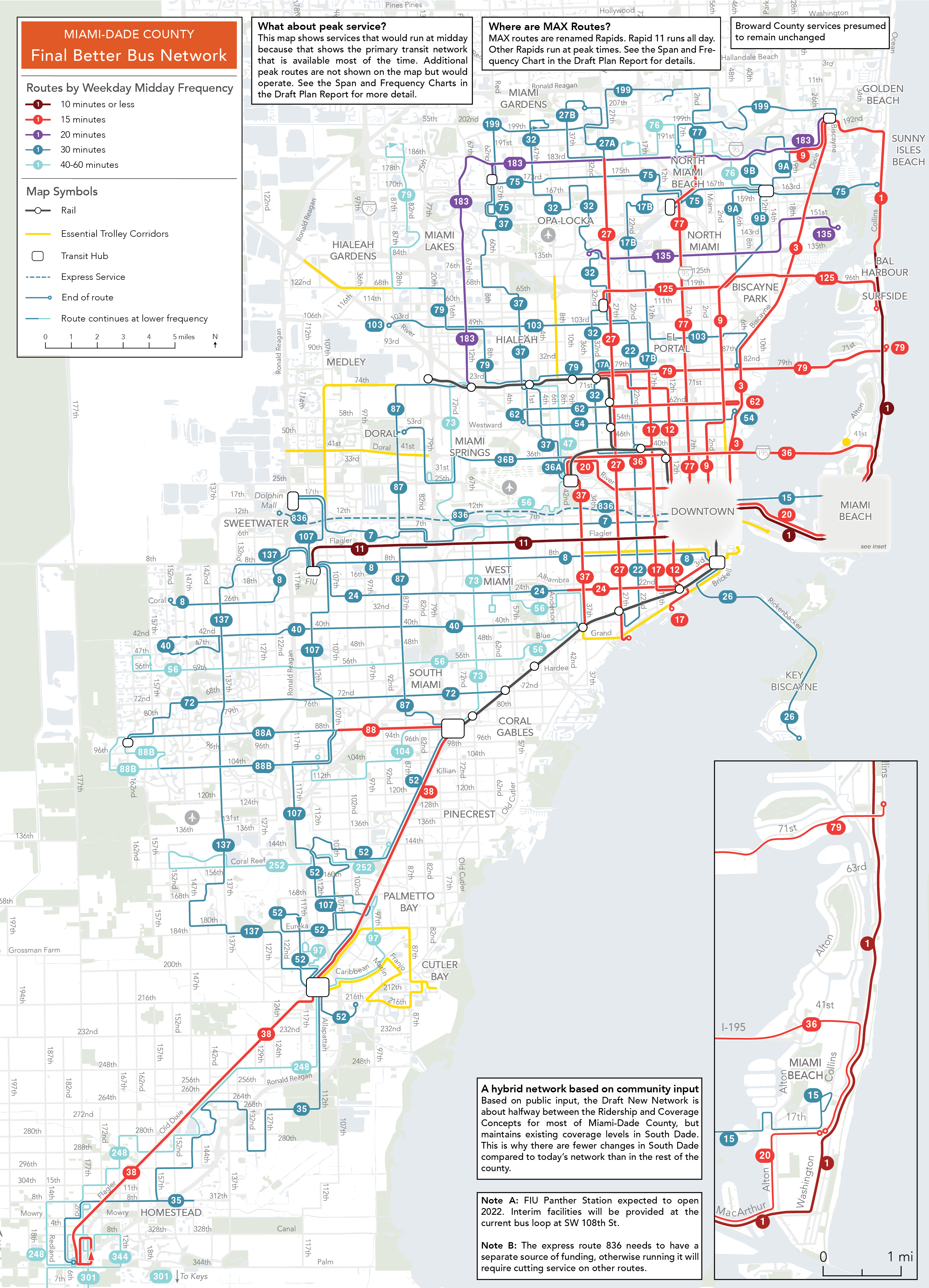
A draft of the New Network is now out and ready for community input, and you can read the full report here. This New Network is based on the public input received on the Concepts released last fall and it reflects a shift in the balance of ridership and coverage goals toward higher ridership based on the public response to those concepts. This New Network has been created in partnership with Transit Alliance, County, and municipal staff, and in particular City of Miami and Miami Beach staff who have helped guide the redesign of municipal trolleys.
The local newspaper, the Miami Herald, has a good article about the Draft Network and the major improvements it provides to most people in Miami-Dade. If you live in Miami-Dade you should study this New Network and take the survey before March 31st.
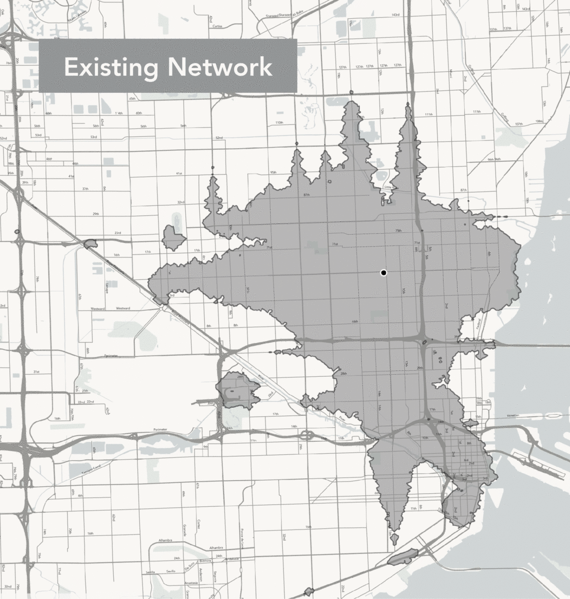
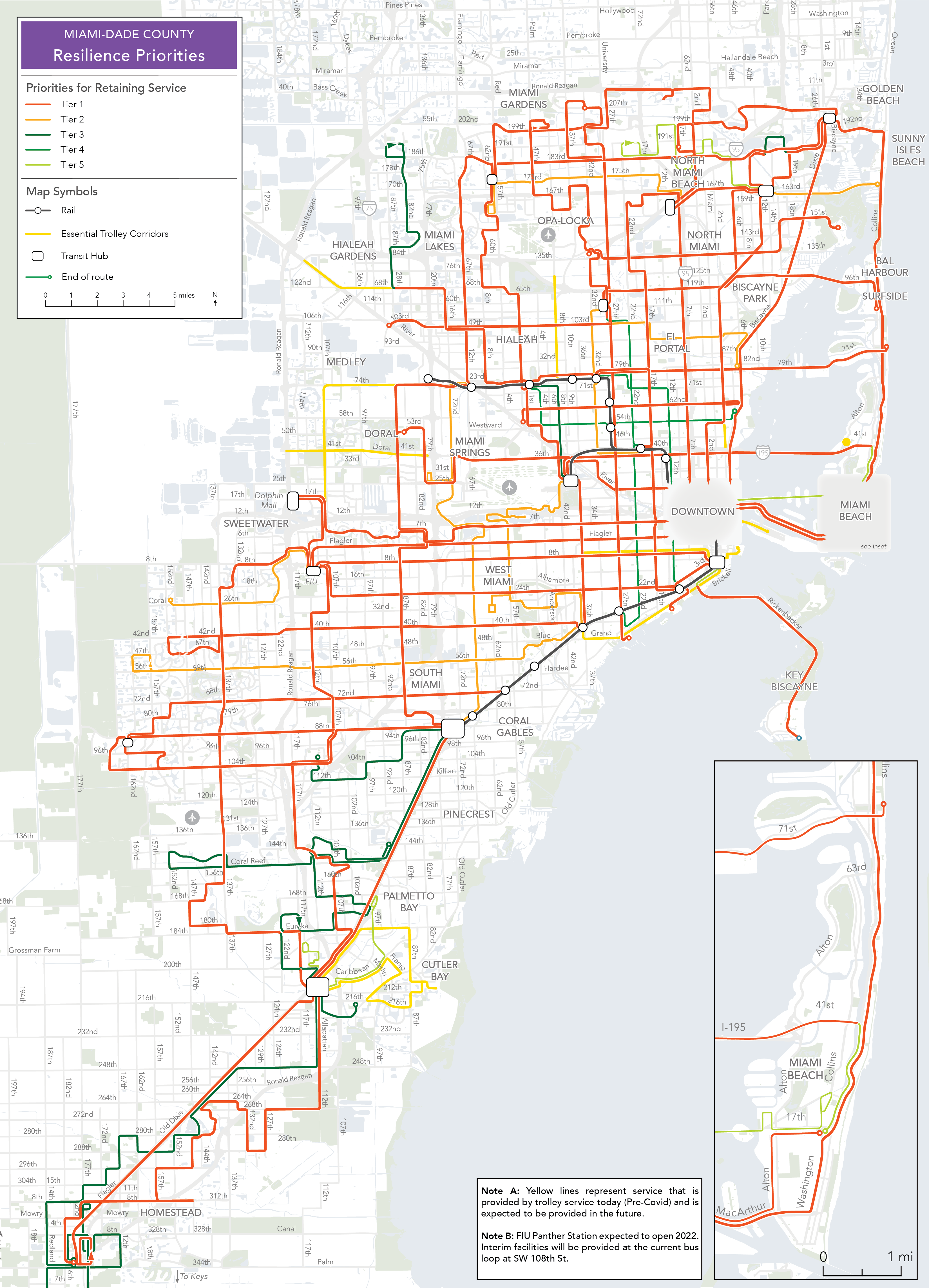
We previously released a Choices Report that highlighted one of the major shortcomings of the existing network, a lack of a frequent grid. The New Network builds more of a frequent grid, at least in the core of the network, through consolidation of closely spaced routes, trading roles between the County and municipal trolleys, especially in the City of Miami, and some reductions in coverage, particularly in municipalities that provide trolley service.
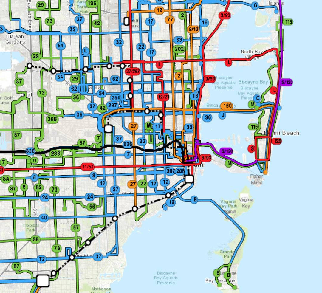
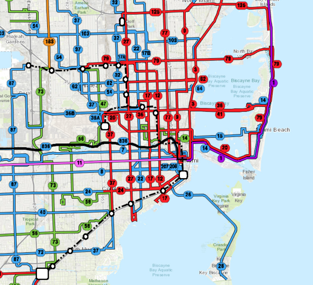
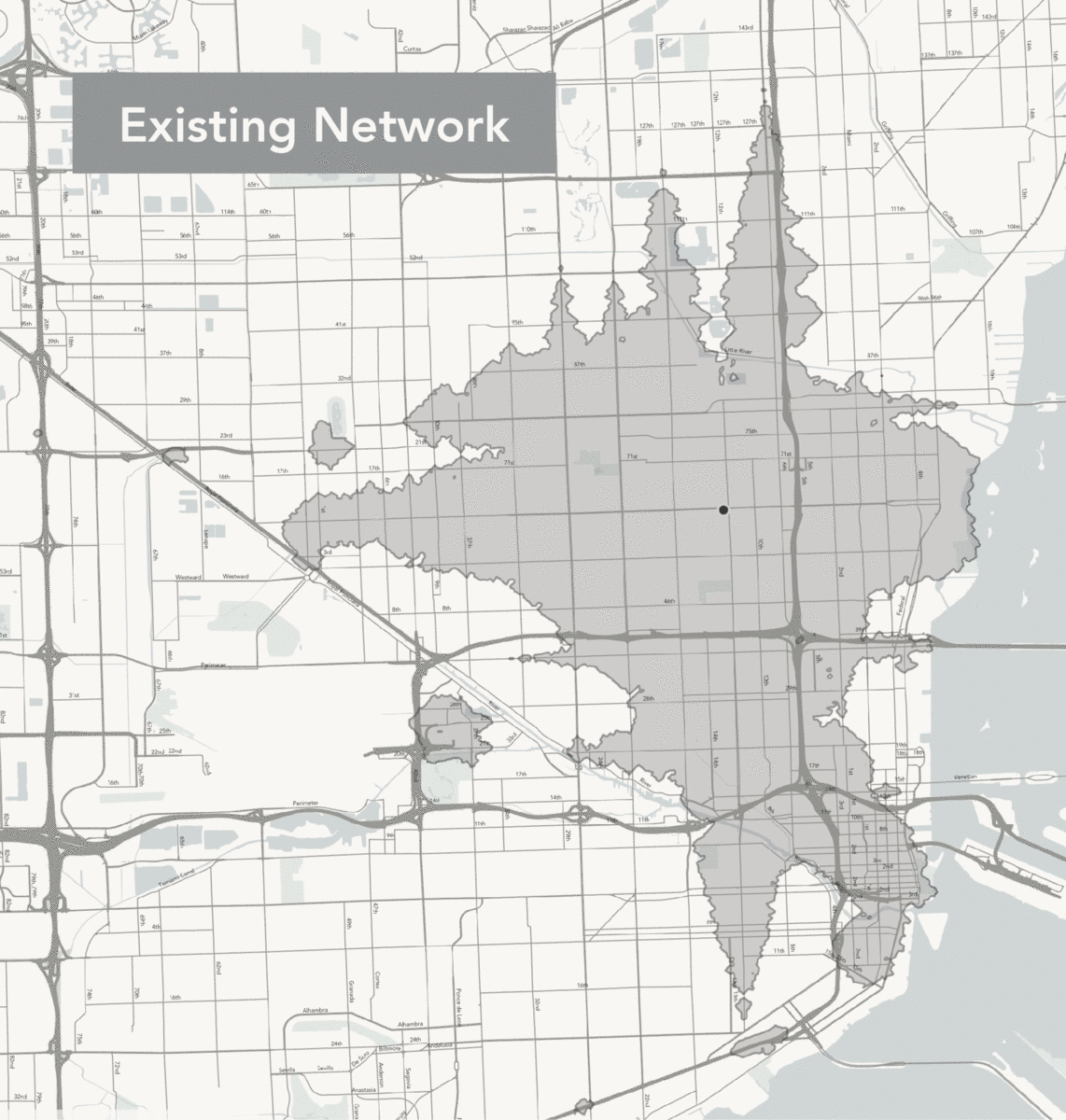
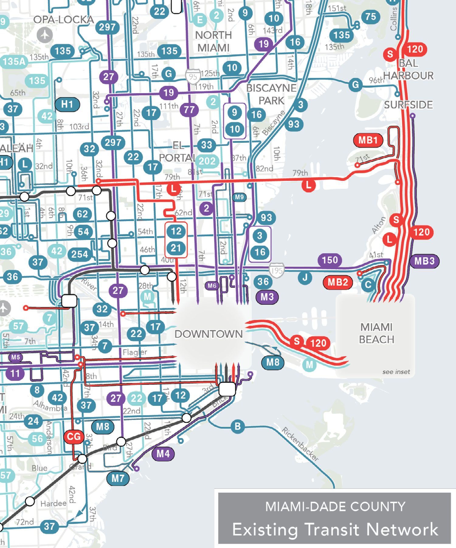
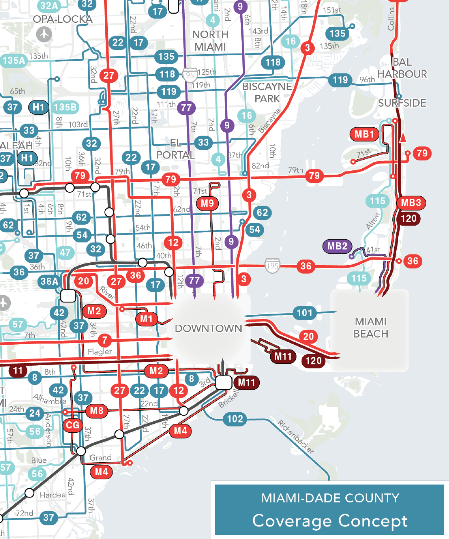
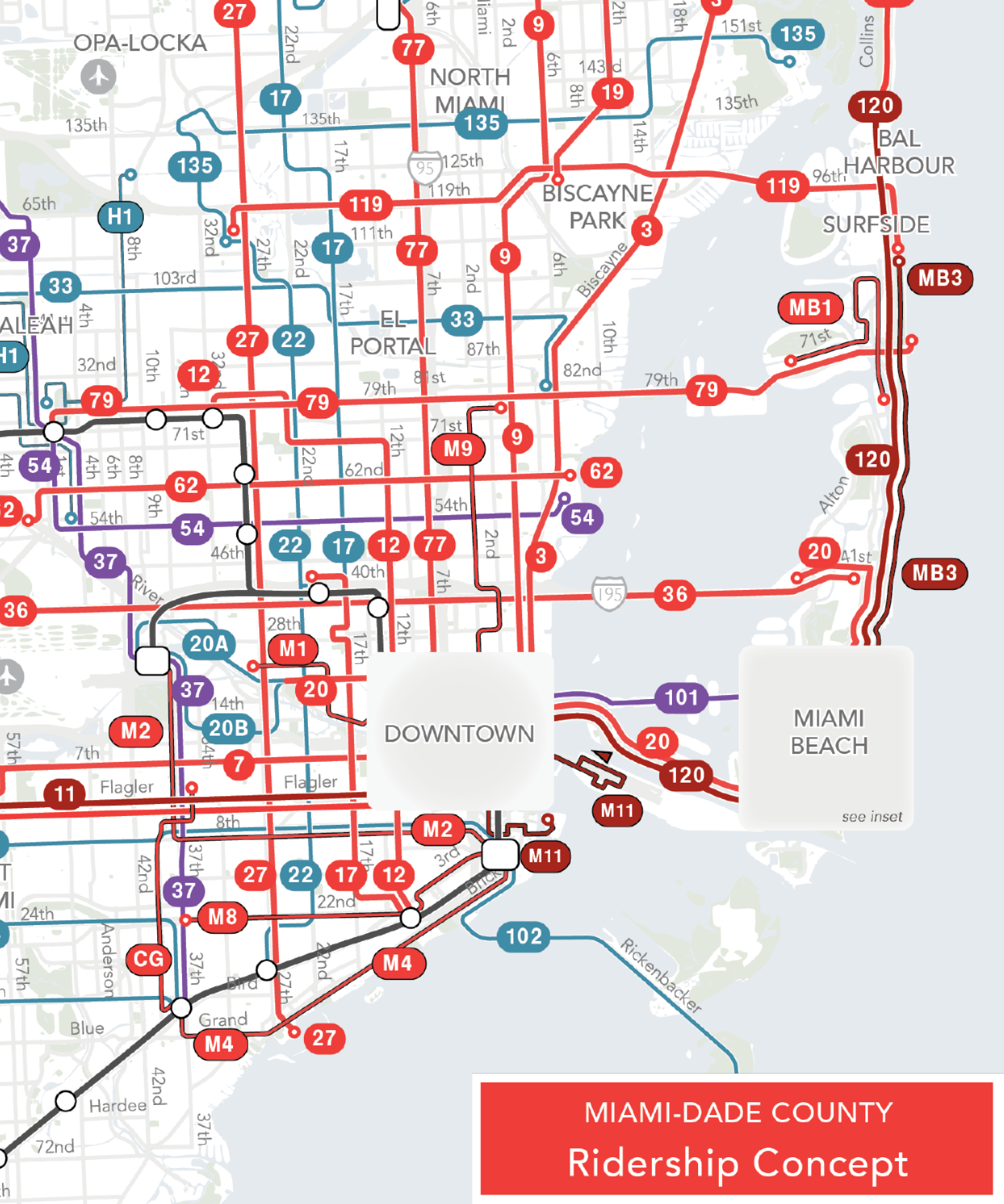
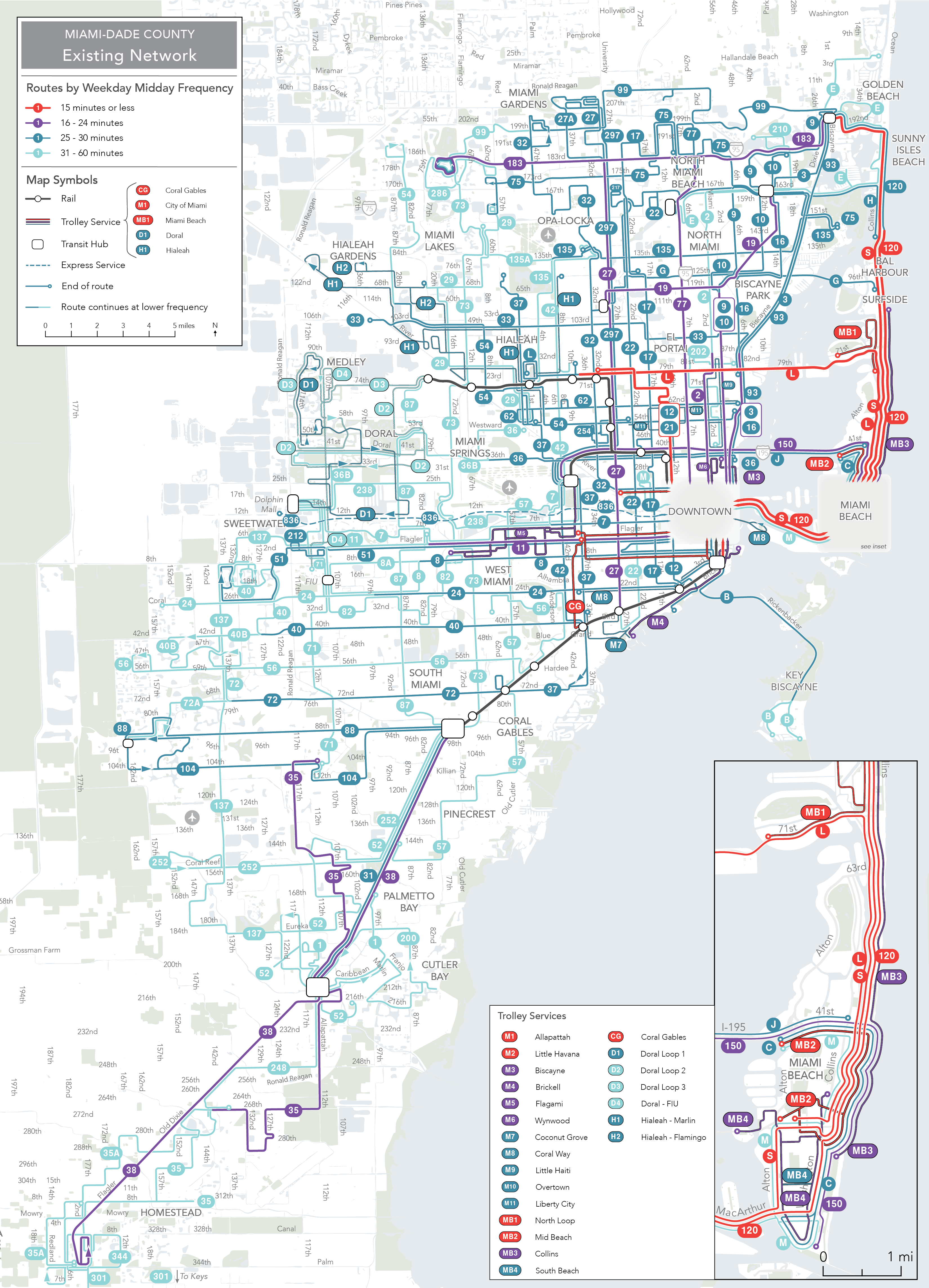
Below are slices of the Existing Network and New Network for the core of the region (click the maps to see the full size maps of both networks).
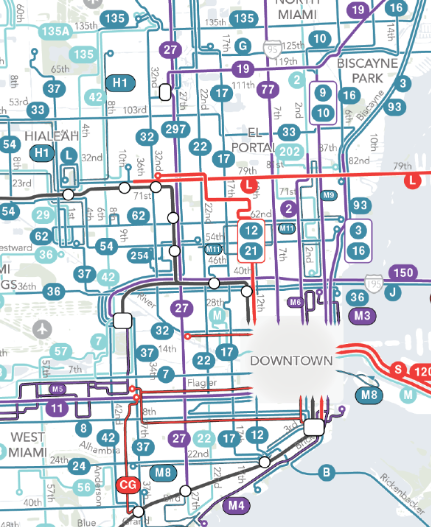
Existing Network
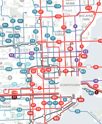
New Network

The result of this frequent grid is that 368,000 more residents are near a frequent route, which brings the total population near frequent service to 25%. In the Existing Network only 11% of residents are near a frequent route.
The power of the frequent grid means that there is a vast expansion in where people can go in a reasonable amount of time. Below is a comparison of where someone who is starting in Liberty City (NW 12th Avenue and 62nd Street) can reach in 45 minutes by walking and transit. The gray area is what is reachable today under the Existing Network. The light blue area is the area reachable with the New Network. The frequent grid in the New Network vastly expands your freedom if you live here and means you could reach 60% more jobs and 55% more people.
We can assess this change for all people and places across the county and doing so gives us the map below, showing in blue the areas where people can reach more jobs and in red the areas where people can reach fewer jobs with the New Network. Each dot in this map represents 100 people.
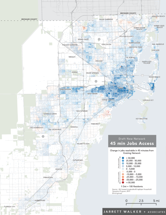
The map shows that the vast majority of people and places see a large increase in job access. Averaged across the entire county, the typical county resident would be able to reach 33% more jobs in an hour with this New Network.
Now these improvements are part of some painful compromises. This network emphasizes Ridership goals more than the Existing Network. Thus, some low productivity routes serving Coverage goals are cut so that more frequency can be provided in dense, walkable, linear places. Overall, about 3% more residents would be more than ½ mile from service with the New Network.
The New Network costs the same as the Existing Network and is fully implementable within six to nine months, but this network isn’t going to be implemented until the public, stakeholders, riders, and others have a chance to consider this change and respond. So, read up and tell Transit Alliance and the County what you think.
If you agree this New Network would be an improvement for Miami-Dade, it’s important to speak up because many people who will benefit from this New Network won’t be paying attention and won’t speak up. And if you don’t like the plan, please let Transit Alliance and MDT know how it can be improved. But remember, any change must be made in a cost neutral way, so an increase in service in one place means we have to cut service somewhere else. We always get great ideas out of public comments at this point.
It’s also important to think beyond current and potential transit riders to all the other interests that will benefit. A vast expansion in where people can get to means better access to jobs, services and shopping across the county. Businesses can see how the plan improves access for their employees and customers. Finally, everyone who cares about transit outcomes – economic, environmental, or social – should care about what this plan could achieve.
Finally, as consultant, we don’t claim that this is all the service that the county needs; it’s just what the county and cities can currently afford. There are obvious places were additional investment in service would greatly improve access for thousands of people. Some ideas for improvement are documented in the Report on the New Network, such as increasing the frequency of service on the 20-minute routes in the New Network (Routes 9, 62, 88). Also, on Sundays most of the frequent network becomes every 20 minutes. In a region with such a large tourist economy, Sunday service should be closer to weekday and Saturday levels.
