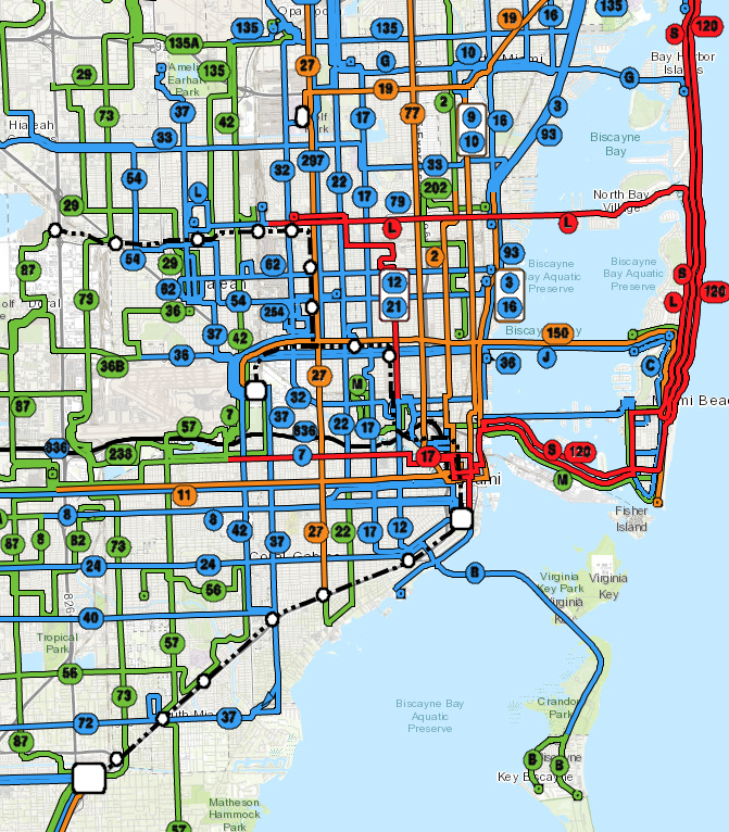
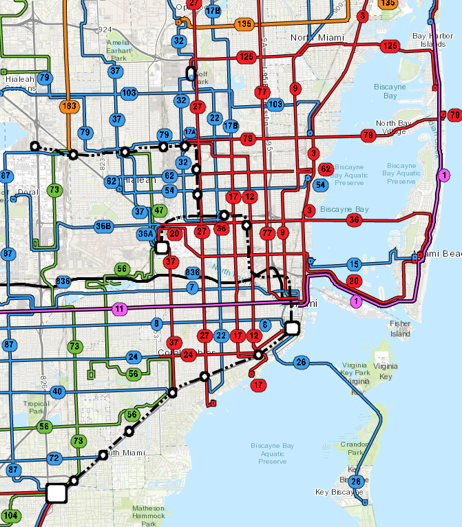
If you are involved in debates about Bus Rapid Transit, you need to think about whether the project will be closed or open, because this will have a big effect on how useful the service is. I’m always surprised at how few BRT projects clearly debate this issue.
A BRT system is open if the buses can continue off the end of the infrastructure and operate as conventional buses on local streets. In situations where multiple bus operating companies run along the same path, open can also mean that the infrastructure can be available to multiple operators, although that almost always implies the first meaning as well.
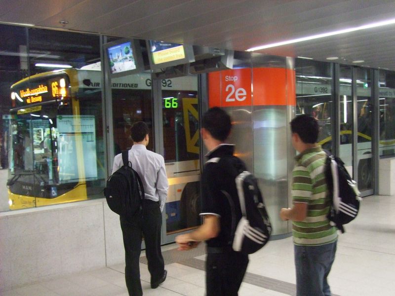
A BRT system is closed if the buses must remain with the infrastructure, so that service must end at the end of the infrastructure, just as all rail services do.
In a given situation, a closed BRT option will require more transferring than open BRT for people to reach actual destinations that lie beyond the infrastructure. As a result, it will tend to lead to longer overall travel times unless the speed advantages of the BRT compensate for that transfer delay.
There are two reasons this is a problem for your actual ability to go places:
- A very single-centered urban form may logically need services to branch as they head out of the city, because as demand gets lower, you need less frequency but needed to cover more area. Branching divides frequency, and in that case this can be OK.
- But the bigger problem is that for non-transit reasons, the infrastructure may end where the demand doesn’t end, and closed BRT in this situation forces a lot of people to transfer just to keep going in the same direction. In a high-frequency grid, for example, it’s important that service operate continuously all the way across the grid, so that while some people will have to transfer once few have to transfer twice. Closed BRT can be an obstacle to this.
Despite this disadvantage, BRT systems are often closed for two major reasons:
- In extremely crowded systems, closed BRT allows for tighter control of operations, for maximum capacity and minimum waiting time. Capacity considerations may also dictate that all buses using the infrastructure be as large as possible.
- In wealthy countries closed BRT more likely to be about trying to mimic the experience of rail transit, so as to be more attractive to a supposed discretionary or “choice” rider. If the goal is to make BRT appear special and different from regular buses, this goal is muddied if BRT buses run outside the infrastructure, or regular buses run inside of it.
The first of these reasons translates into measurable benefits in travel time, and thus access to opportunity, while the second does not.
Closed BRT is the more common kind of BRT in the United States, mostly for the second reason. Where it appears in developing countries with very high public transit demand, it is mostly for the first reason.
BRT can be closed by any of three design choices:
- Station and fleet incompatibility. Stations and buses may be designed so that they can only be used together. For example, Eugene, Oregon’s BRT can run in regular lanes and even in mixed traffic, but its stations have high platforms that only match the floor height of the designated BRT buses, effectively requiring a closed system. Fleet incompatibility can also be created through electrification, especially if end-of-line charging stations are required. These stations become barriers to continuing service beyond the end of the line at that station, because the charging requires an amount of time that is practical only at the end of the line when no passengers are on board.
- Full separation. It can be made physically impossible for buses to enter or leave the infrastructure. This is very unusual, since buses may need to enter or leave in emergencies or to travel to and from the operating base.
- Operating plan. Service can be operated as closed even though the infrastructure doesn’t physically prevent open operations.
So should a new BRT system be open or closed?
In most cases, the advantages of open BRT are about people being able to go places so they can do things. The advantages of closed BRT are mostly about branding and some limited kinds of amenity.
Brisbane, Australia’s BRT system uses ordinary buses that continue onto local streets, but it’s still really, really nice.
The concept of amenity is worth unpacking. Many great amenities are possible on open BRT – see the beautiful busway stations of Brisbane, for example – but these generally do not include special buses with special features, unless you buy enough of these that they can continue to wherever those buses logically need to go to create the most liberating possible network. There’s another reason to be cautious about special buses: Really, all buses should be nice, so creating a distinct brand of buses amounts to disparaging the rest of the bus system as much as it’s promoting the BRT. We may be spending a lot of capital money to promote the idea that most buses are inferior.
But a few things, such as absolutely level boarding, benefit from buses that stop exactly at the platform level, and these buses tend not to be able to stop an ordinary bus stop. Absolutely level boarding is great, and especially important to people using mobility devices. But well-designed open BRT, with good operations and training, can still do reasonably level boarding where it’s easy to cross with a wheelchair or stroller.
I said “in most cases,” open BRT offers the best travel times and thus the most access to opportunity. So what are the exceptions? Closed BRT can be more efficient at very, very high levels of ridership – such as we see in big cities in less wealthy countries. Here, an entire corridor may be continuously very busy, and in this case, the most efficient operations, and hence highest capacity, arise from being able to use every bit of the infrastructure and keep buses evenly spaced. This is harder to do with open BRT, because buses may be entering or leaving the infrastructure part way, thus leaving a part of the infrastructure with fewer buses. Buses may also be entering unpredictably, because they are coming from route segments where they are running in mixed traffic and thus subject to delay. Where such huge volumes of people are traveling, these problems can cause pass-ups that do measurably reduce travel.
But this important exception arises only where massive capacity is critical, and this case rarely arises in the moderate-density wealthy countries of North America, Australia/New Zealand, or even most of Europe. So in those countries tends not to offer any advantage to people’s ability to go places so they can do things. In these contexts, closed BRT can deliver a better “brand” or “look and feel”, but open BRT is more likely to get you to our destination as soon as possible. You decide which matters more.