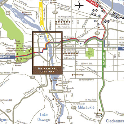
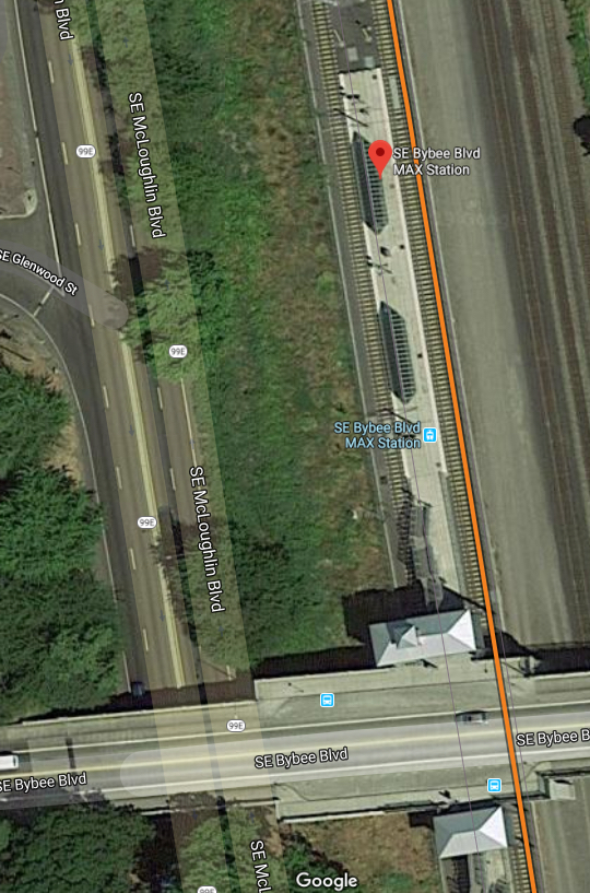
That red line (and the adjacent blue line that’s hard to see) is the east-west spine of Portland’s transit system. On the west, it is one of just two direct paths (street or transit) across the hills linking downtown and the the “Silicon Forest” suburbs to the west. But the slow operations across downtown makes this line much less useful than it looks. Credit: Travel Portland.
In 1986, Portland opened one of the first modern light rail lines in the US, the beginning of a light rail renaissance that built networks in mid-sized cities across the country. It was nice to be a leader — we’re used to that in Portland — but it also means that everyone has learned from our mistakes, while Portland still has to live with them.
Perhaps “mistake” is too strong a word, but the priorities of the early light rail designers certainly aren’t the priorities today. Planners of the 1970s (when I was an enthusiastic teenage transit geek) confronted a city whose downtown consisted mostly of surface parking while prosperity fled to the suburbs. Their top priority wasn’t even getting people to downtown. It was making downtown a place worth going.
So they built a line that rushes into the city from the eastern suburbs, but then creeps across the inner city, making lots of stops for a net speed under 7 miles/hour. For a while that was fine. All those stations meant lots of development sites right next to the line, and downtown grew and prospered.
Today, the success at revitalizing downtown has created an opposite set of problems. Downtown and the surrounding neighborhoods are so successful that working people can’t afford to live there. Low income people are being pushed out to places where they face longer commutes. Most important, the line now continues west out of downtown to serve the “Silicon Forest” suburbs to the west, so that it runs across downtown, not just into it. Meanwhile, the development that the slow downtown segment was supposed to stimulate is largely done.
So the downtown segment of the line is becoming more of a barrier than a resource.
Transit in Portland benefits enormously from chokepoint geography. Between the inner city and the western suburbs, there is a wall of hills pierced by one gridlocked freeway, one parallel arterial, and a light rail line. This rail segment has prospered because the driving alternatives are terrible.
As always, chokepoint geography means: It’s worth spending a lot of money improving transit here, because so many trips, between so many places, go through this point. A regional inbalance of jobs and housing (more jobs in the west, more housing in the east) has create a huge east-west travel demand right through this ch0kepoint. The hills are still a barrier for drivers, but for transit the barrier is the slow downtown streets, and the 1970s assumption that the train needs to stop near every building.
As if the slow operations weren’t bad enough, there’s also a problem of capacity. Portland’s adorable little 200-foot blocks, rightly credited with giving downtown such a human scale, limit the train lengths to 2 cars as long as they run on the surface. The city is too big now, and its transit needs too dire, for such tiny trains to do the job.
The problem is being attacked at several scales. The transit agency is gingerly suggesting that a few stations should be closed. Stations on the downtown segment are as close as 350 feet — far too close for bus stops, let alone rail stations. (The newer north-south light rail line, whose designers learned from the mistake, has station spacing closer to 1000 feet. Unfortunately, it is the east-west line that extends furthest into the suburbs and therefore serves the most people.)
But the problem is so big, and obstructs so much access to opportunity across the region, that it won’t be solved just with half measures. A long overdue study is looking at the complex of capacity problems, and while it’s looked at some half-measures, the only thing that solves all the problems is a new segment of subway under the core. The long frequent east-west lines serving suburbs (and the airport) would go into a tunnel, rushing under downtown in perhaps 1/3 the time, so that transit would finally be viable for travel across downtown and not just to it. The existing surface line would still be used to provide a more local service across downtown.
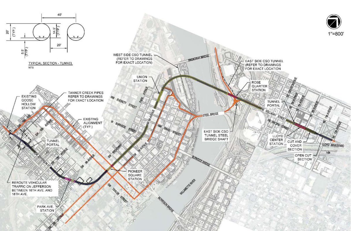
An early concept for the downtown rail tunnel (black) with existing light rail segments in red. The tunnel has six stations counting the endpoints. Too many?
I have been skeptical of many rail projects in my time, but the most defensible of all are these “core capacity” projects. Like the excellent Los Angeles Regional Connector, this is a project that is in downtown but not for downtown. Its purpose is to unlock the potential for all kinds of access across the region. To bypass the inevitable edge-core debate, it will have to be presented in those terms.
That’s why I’m a little skeptical of the earliest concepts. As sketched the tunnel has six stations downtown. They should at least study a line that just has three: the two edges of downtown — Lloyd Center and Goose Hollow — where the fast line would connect with the slow surface line, and just one station at the very center of the city, Pioneer Courthouse Square, where almost all of they city’s radial transit services meet. This would make the new line barely half as long and much less expensive.
Obviously there are great arguments for every proposed downtown station: the university, the stadium, the train station. But it’s going to be important to have clear conversations about the balance between downtown and regional benefit, and between the benefits to an already prosperous downtown and the need for reasonable travel times for low income people, who are increasingly pushed further out where they have to travel further.
I don’t know that a three-station solution is right, but I know it should be looked at. It’s really easy to get around downtown on transit, from anywhere to one of the three stations that this minimal version would offer. It’s really hard to get across the region, and every station we add to this project moves us back toward not solving that problem — not just by making the line slower but also by making it more expensive. It’s a tough balance, and I hope we’ll have the debate.