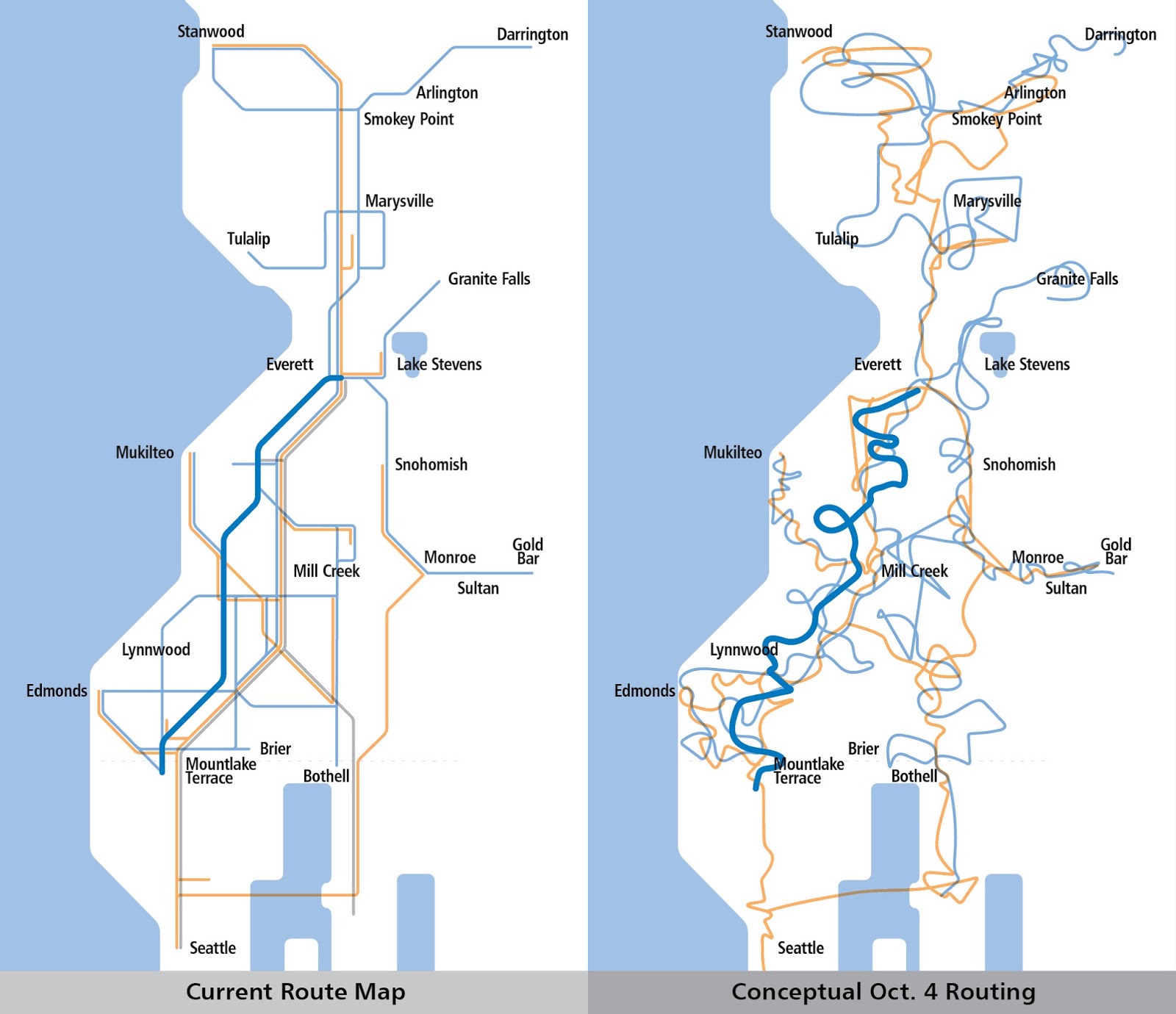
Last week, Taylor Huckaby was manning the Twitter feed at San Francisco’s regional rapid transit agency, BART, during a tough morning. Mysterious electrical faults were causing cascading delays, and Twitter boiled over with rage. Suddenly, Huckaby started tweeting in ways that got attention.
Quite deservedly, this and 57 similar tweets went viral, even making it to the New York Times. Vox, one of the more transit savvy of US national media outlets, got it right: BART “stopped being polite and got real.”
Inspired by Huckaby, let me put this more generally: Politeness and deference are always the first impulse of transit staffs dealing with the public, but sometimes politeness turns into a habit of apologizing for everything and anything, and at that point, staff is consenting to abuse. Few public servants take as much public abuse as transit agency staffs do, almost always because of problems that are out of their control.
Imagine Huckaby’s position. His job is to communicate on BART’s behalf, but because of decades of decisions by past leaders (regional, state and national, not just at BART), his beloved transit system is betraying its customers. It’s certainly not Huckaby’s fault. In fact, he understands the issues well enough to know that it’s probably not the fault of anyone working at BART today.
In this situation, the usual vague apologies would amount to misleading the public. Huckaby deserves his heroic moment, because he did exactly what transit agencies need to do: Find the courage to say the truth, because while people will yell at you when you do, nothing will ever improve if you don’t. But don’t let me make that sound easy; it’s not.
Some of the early coverage, including that Vox piece, gave the impression that Huckaby had just snapped, “lost it,” gone rogue, but Huckaby has now spoken up to justify his comments, stand up for transit staffs, and properly blame some of BART’s problems on a broader US tradition of infrastructural neglect. BART management seems to have his back, and Los Angeles Metro tweeted this great video snippet, suggesting that they do too.
Mad at how bad your transit service is? Maybe the problem is with people and cultures at the agency now, but maybe it’s because of decisions made at higher levels — regional, state, and federal — often outside the agency. It’s easier if all those people if the frontline staff takes the blame, and are trained to just apologize all day. But that never solves the problem, and what’s more, it’s abuse.