Urban Structure

Induced Demand: An Axiom of Biology

Figuring out the relationship between this tweet and this article is left as an exercise for the reader.

Induced demand is the observed fact that if you make something easier to do, people will do it more.  For example, if you create new capacity for cars in a place where travel demand is high, the result is more cars.  If you build more capacity to “fix congestion”, you end up back near the same level of congestion you had before.

After decades of observing this pattern, most people are still reluctant to face what this means.  Part of the problem is that we’re presenting induced demand as an observed discovery, which allows us to quarrel over data, research methods etc.

But induced demand isn’t just an observed fact.  It’s also an axiom of biology.  We are as sure about it as we are of the facts of math.  This means we don’t really need to be doing this experiment over and over, just as we don’t need to keep measuring circles to be sure of the value of pi.

In this context an axiom is a statement that can be taken as true because it is part of the definition of a concept you are using, or follows logically from that definition.  The value of pi is axiomatic because it follows from the definition of a circle, in standard Euclidean space that describes our everyday world.

Now consider the concept of an organism.  It implies that:

  • The thing consumes some resource from its environment, in order to have enough energy.
  • It will expend energy getting this resource.
  • Therefore, it must run a positive balance sheet: The energy it spends getting the resource must be less than the energy the resource will provide.

We humans are organisms, so we do what they do.  In particular:

  • To have enough energy, we seek resources.  Money is a symbolic resource in this sense.  We also have other needs like shelter and security that also require resources.
  • We need to get these things in way that minimizes energy costs.  This is what I mean by easy.

We are mobile creatures, rather than barnacles or oysters, so this pursuit of resources often requires traveling. This means that time is also part of this basic calculation that determines survival.  The time spent pursuing a resource can’t be spent pursuing other resources, or doing other necessary things like sleeping.  So we must minimize our costs in both energy (which includes money) and time, while gaining as much energy (money) as possible.

From this it follows that people will tend to travel in ways that maximize their access to resources while minimizing energy cost (time and money) and danger.  People don’t always do this exactly, but the underlying biological imperative is unavoidable.

This means that:

  • If driving suddenly becomes easier (lower time and energy cost) than taking transit, more people will shift to driving, increasing congestion.  This is why road widening in high-demand places tend to lead to more traffic.
  • If a road widening makes it possible for developers to save money (i.e. energy) by building in more distant places where land is cheaper, they will do that.
  • This process changes the shape of the urban area so that people travel longer distances (due to sprawl) at slower speeds (due to congestion).
  • Therefore the average organism will need to expend more time and energy to reach the same resources it reached before.  (Your job flees from downtown to a distant business park where taxes are lower.  Your grocery store closes because a WalMart opened two miles away where you can’t walk to it, or even walk from the nearest point that a bus could get to.)  The organism will also be exposed to more danger as a result.
  • On average, organisms in this system end up in a weakened state, with a worse balance sheet of energy expended vs energy gained.

The organisms in this story are all trying to harvest more energy than they spend in the act of harvesting.   Even unimaginable aliens on distant planets would do this in the same situation.  So it’s axiomatic that, in the absence of other pressures, road widening in a high-demand area will induce more traffic and more sprawl.

So although road-building departments keep doing the induced demand experiment many times every year, and getting the same results, you don’t need to do more experiments, just as you don’t need to keep measuring circles to be sure of the value of pi.  You can add complexity by taking this into the human sciences and trying to model subtleties of human behavior, but all the resulting insights will be marginal compared to the axiomatic fact that above all, we’re organisms, so we’ll do what organisms do.

A US Density Revolution?

These two things are connected!

In major cities and some states across the US, the tide seems to suddenly be turning in favor of density.  James Brasuell at Planetizen has a thorough survey of these efforts.  Read the whole thing.

An inescapable trend emerged in recent years and months: a large and growing number of communities are now engaged in comprehensive plans and zoning code revisions, and they’re doing that planning work in the hopes of creating a future that is fundamentally distinct from the 20th century model of planning.

But the revolution Brasuell describes is about much more than planning documents.  The story is political:  In response to the housing crisis, both city and state politicians are producing legislation that makes it easier to build densely by:

  • reducing off-street parking requirements, which makes denser development pencil out and can also make units more affordable
  • streamlining transit-oriented development, including around frequent bus corridors and
  • most controversially, allowing more density in neighborhoods that have long been legally protected as exclusively for single family homes.

All this is great news, not because everybody wants to live at high density but because more people want it than can currently afford it.  The extreme cost of living in dense and walkable cities is the sound of the market screaming at us to build more of them, and finally that’s becoming possible.

From a transit perspective, I have one note of caution when it comes to upzoning absolutely everywhere.  Most cities have places that are hard for transit to get to, and where a few more people will create transit demand that is very expensive to serve.  Sometimes they are physically hard to reach: long cul-de-sacs, squiggly streets, etc.  But sometimes too they are so sparsely populated that they are poor transit markets and adding a few more people isn’t enough to make them better.

Gentle upzoning of single-family areas — allowing second and third units on formerly single-family parcels — is mostly helpful, but not always in these tough spots.  In any case, serious density must be organized around the frequent transit network — bus and rail — so that more people end up in places where transit can be really useful to them.   Don’t know where yours is?  There should be a map of it somewhere, reflecting a policy adopted by both your transit agency and your city government!  It should be on the wall in both the transit agency and the city’s planning and traffic offices.  (See Chapter 16 of my book, Human Transit, for more on this tool.)

Transit is expensive.  It succeeds when it can run in straight lines through dense and walkable places, so that it has enough ridership over a short enough distance that it can afford high frequency.  A policy frequent network, agreed upon by the transit agency and the city government(s) and manifested in both zoning and traffic planning, was critical to jumpstarting the growth of transit in Seattle, which is now one of the US’s great success stories.  It could make a difference for your city too.

How Important is “Downtown”?

In North America, the word downtown invites us to imagine the densest and most walkable part of any city, the place where transit and other non-car modes naturally thrive more than anywhere else.  And where this is actually true, it's logical for all kinds of intercity and local transit services to focus there.

But when we project this model of downtown onto every city, we encounter fatal confusions.  Downtown implies a single place; there's just one per city or metro area.  But some cities aren't like that.  Los Angeles and Houston, two take two famous examples, have a place called downtown, but it's really just a slightly larger cluster of towers among many clusters of towers dotted across the region.  Downtown in this model is not like a center of energy around which the whole city revolves.  It's like the brightest of a bunch of stars in a constellation, and not even the brightest by much.  

So if you cling to the notion that downtown means "focal point of travel demand and especially transit", then you have to embrace the concept that an urban area may be a constellation of many downtowns.  This is not just an American sunbelt idea.  Most of the population of the Netherlands is in a single metro area called the Randstad; it's made of many small cities each with its own downtown, with a shared airport near its centroid.  Many Asian cities are so uniformly and extremely dense that almost any point in the city could be called downtown, so long as there is some mixture of uses.  All of Paris is about equally dense, with government, business, and retail districts all over the city and the tallest towers around the edge of it, so good luck finding "downtown" there.  

In Citylab, Eric Jaffe gives us the supposedly bad news that the proposed Dallas-Houston High Speed Rail (HSR) line won't go to "downtown" Houston.  Instead it will end at Northwest Mall, just outside the I-610 loop in the northwest of the city.  

But most of the Houston transit-advocates I've talked with aren't sounding nearly as upset.  That's because:

  • the proposed terminal is close to the centroid of Houston as a whole.  It's also very close to Uptown-Galleria, the region's second downtown, and to Northwest Transit Center, the busiest transit hub in the western 2/3 of the city.
  • the terminal station area is massively redevelopable.  You could easily build yet another downtown there, and if HSR is built, they probably will.
  • the project will provide great impetus for light rail or Bus Rapid Transit linking the station to the original downtown.  These projects have been sketched many times and could include either I-10 nonstop links or a refurbishment of Washington Street, a promising old streetcar street linking the two nodes.
  • in high speed rail, the cost of the last miles into an historic downtown can be a huge part of the cost and grief of the whole project.  So if you want high-speed rail to happen at all, provoking this battle is not always a sensible part of Phase 1.

The bigger challenge, for folks from strongly single-centered cities, is to notice the limits of the term downtown.  As cities grow, there is no correlation between the sustainability of a city and its single-centeredness.  On the contrary, single-centered cities present huge problems for transportation, because they use capacity so inefficiently.  New York, for example, is spending over $10 billion on a project to fit more Long Island commuter trains into Manhattan, and to put them closer to jobs there.  The demand is mostly one-way, so this requires either storing trains all day on expensive Manhattan real estate, or running them all empty in the reverse-peak direction.   It's very inefficient compared to the transit problem in a multi-centered place like Paris or Los Angeles, where demand is flowing two-way most of the time.

So growing a single downtown isn't the key to becoming a great transit city.  Quite the opposite, it's best to have a pattern of many centers, all generating high demand, and supporting balanced two-way flows between them that let us move more people on less infrastructure.  This is the great advantage of Paris or Los Angeles or the Dutch Randstad over Chicago or Manhattan.

So remember: when it comes to the efficiency and abundance of transit — or roads for that matter — "downtown" isn't all it's cracked up to be.  For transit, big clumps of density and walkability are great, but several are better than one.

Reykjavík: Adventures in Subarctic Urbanism (Part 1: the Photos)

I recently returned from a week in Reykjavík, Iceland, working with staff of the regional association of municipalities on the frame of a future public transport plan.  It was an opportunity to meet with key elected leaders – including Reykjavík Mayor Dagur Eggertsson and public transit authority chair Bryndís Haraldsdóttir – for a conversation about what they want public transit to be, and what choices might follow from those goals.  I also ran a two-day workshop for municipal and national transport staffs, to help them explore their options for their transit future.  (There was also some time off to ruminate on the landscape; those musings are on the personal blog, here.)

Part 1 of this post is a photo-rich tour.  Part 2 talks through some interesting transport issues.

Greater Reykjavík is dramatic urban landscape, all perched on ridges or gathered around fjords.  As in any European city, there’s a walkable historic core, attractive to tourists but still intensively lived-in by the locals, and with plenty of cranes on the edges signaling even greater density in the future.

IMG_6313

But despite the European forms, urban history is on a more North American scale. Although the very first Norse settlement was on this spot, in 870, it was another 900 years before anything urban began to emerge.  So the inner city urban structure is mostly 18th-19th century, and the buildings are mostly from a range of 20th century styles.  (The hilltop church, too, is 20th century.)

IMG_5861.JPG

It can seem a little austere sometimes, partly because so much of the greenspace is hidden behind buildings, along laneways.

IMG_6324.JPG

IMG_6322.JPG

And here are some classic waterfront photos reminiscent of Vancouver.

IMG_6349

Note the cyclist’s shadow; at 64 degrees latitude, the beautiful qualities of evening side-light last for much of the day.

IMG_6370

That giant tennis ball floating in the harbor seemed a perfect bit of whimsy.  It’s a park, with a military history.

Further out, much of the city is high-density but car-oriented:  Residential towers grouped at some distance shops and services, so that even though you live on in a tall building, you need to get in your car to buy a liter of milk.   This is the view from the 20th story conference room where we held our staff workshops.  This particular office tower has a freeway offramp directly into its parking lot, but the area is so riven with high-speed roads that it’s difficult for transit to navigate without lots of awkward backtracking – the “be on the way” problem.

IMG_6294 inverted

The white tower in the distance in the upper right of that photo is that modern hilltop church in the old city.  You’re looking across most of the urban area in this image, so you can sense its compactness, its topographical complexity, its extensive greenspace, but above all, its density.

In Part 2 (the Words) I’ll talk more about the transport issues.


Basics: Public Transit “Integration” or “Seamlessness”

When you hear the word integration or seamlessness in conversations about transit, it usually means making it easy to make trips that involve multiple public transit agencies or operating companies.  (In the US we are generally talking about entangled government agencies, but in countries where private operators control patches of the network, the issue is the same.)

The San Francisco Bay Area has long been one of North America’s most difficult integration challenges, so it’s a good laboratory for exploring the issue.  If you can get transit integration right in the Bay Area, you can probably do it anywhere.  The Bay Area’s particular challenge is that it has no recognized central city.  Instead, it’s named after an obstacle, the Bay, and its geography of bays and hills provides natural psychological divides.  Wherever you live in the Bay Area, most of the Bay Area is “across the water” or “over the hills” from you, and this matters enormously to how people perceive issues as local or regional.  (Los Angeles, mostly a city of vast continuous basins, could not be more opposite.)

Screen Shot 2015-08-03 at 11.31.30 AM

The San Francisco Bay Area, with county lines


Fig1-WholeBayArea BS2_REV3_040915

Map of Bay Area transit agencies (SPUR, “Seamless Transit” 2015)

The key types of seam are:

  1. Fare barriers, where a trip involving two agencies requires paying both agencies’ fares, and sometimes also keeping track of two kinds of ticket or pass.
  2. Information barriers, such as the lack of a clear map.  (In many regions, the only regionwide map, if it exists, is more like a diagram of turf.  It’s designed to clarify what agency controls what rather than help people understand their travel options.)  Other information barriers include information systems that don’t describe how to use other agencies’ networks to complete common trips.
  3. Service Design Barriers, where a route ends at an agency boundary even though almost everyone on the bus is trying to go further.
Regional-Transit-Diagram

A typical old regional transit diagram, showing areas of turf but no sense of what service might be useful (no indication of frequency, for example).  (MTC)

For decades, it’s been easy to propose that some grand merger of agencies would solve problems of integration, but the obvious problem was you would have to merge the whole Bay Area into one transit authority serving almost 8 million people, in a region around 100 miles long.  That population would mean little citizen access to the leadership, while the huge area would mean that people planning your bus routes may be working in an office 50 miles away.  It just doesn’t work when the sense of  citizenship is as understandably decentralized as it is in the Bay Area.

What’s more, if you value transit-intensive core cities, places like San Francisco and Oakland, or if you want your city to be more like those places, you have an especially strong reason to want local control.  These places need more transit than the whole region wants on average, so they will struggle to get adequate service from a regional transit agency, whose decisions will tend to converge on the average regional opinion.

Many North American regions are seeing conflict around this issue, and are evolving a fascinating range of solutions.  Many of these solutions involve additional funding from the cities that want more transit than the regional average.

Some core cities are proud to have their own city-controlled transit systems separate from what regional agencies do (San Francisco, Toronto, Chicago).  Some pay their regional transit agency for a higher level of service in the core city (Seattle, Salt Lake City).  Some run their own transit systems overlaid, often messily and confusingly, on the regional one (Washington DC).   Many more core cities are going to face this issue soon, especially if regional politics continue to polarize on urban-exurban lines.

Apart from the issue of urban-exurban differences in the need for transit, there are also real challenges when a single transit agency becomes enormous, especially if it provides local service over a vast geographic area.  Los Angeles is a great example.   As an undergraduate in the 1980s, living in the region, I marveled at what I assumed to be the stupid chaos of provincialism.  The region had a big transit agency, which has evolved into what we now call LA Metro, but many cities within the region ran their own transit systems, which were tangled up in each other, and with the regional agency, in complex ways.  As an undergraduate, I assumed that progress would mean merging all this into one giant agency that could provide the same product everywhere.

And yet: in those days, everyone hated the regional agency, but loved their city ones.  And there were good reasons for that that weren’t anyone’s fault, and still aren’t today.  You could get your city’s transit manager on the phone, but not the regional one.  Small city governments can fix a bus route and put up a new bus shelter in the time it would take the regional agency to organize the right series of meetings.  Again, nobody’s at fault there; these are natural consequences of smallness and bigness — in corporations as well as in governments.

Which is why, even in Los Angeles, the trend is not toward mergers.  Today, many city systems in the county are doing excellent work at their local scale.  LA Metro has improved massively as well, of course, but its costs are still high; more important, it’s still very big and therefore inevitably feels distant to many people — again, not the fault of the folks working there.

Meanwhile, a clearer negotiated boundary between regional and city functions is slowly starting to emerge.  One idea, for example, is that a key role of city systems is to run services that don’t meet regional standards for ridership, but that the locals feel to be important.  The division of labor among agencies is not what anyone would design from scratch.  But great work has been done over the years to build clearer relationships, or what I will call, later in this post, “good fences.”

City-operated transit is growing more popular in North American for another excellent reason:  Most of transit’s ability to succeed is already controlled by city government: specifically the functions of land use planning and street design.  If a city government feels in control of its transit, it is more likely to exercise those other functions in ways that support transit rather than undermine it.  San Francisco’s recent decision to combine traffic and parking functions with transit under one city agency shows a new way of thinking about the need to get this right, but it would be impossible if San Francisco relied on a big regional agency for its transit service.  Whenever someone proposes to turn a city transit system over to a consolidated regional agency, I have to point out that integrating in one dimension (between geographically adjacent services) means disintegrating in another (between key functions of city government.)

So there’s no simple answer.  City control creates a nasty patchwork of geographic integration problems across adjacent cities in a region.  The big regional agency has a different integration problem, which is with the land use and street design functions of municipal governments that don’t control their transit and therefore have trouble caring about it.  Whichever thing you integrate, you’re disintegrating the other.

What’s the answer?  It’s for each region to feel its way through the inevitable tensions to its own solution.  But I’d propose we start old fashioned idea made famous by a Robert Frost poem:

Good fences make good neighbors.

Neighbors have an easier time being friendly if they have a very clear agreement about where their boundary is.  Collaborating with your neighbor to mark the boundary, and fence it if need be, is a peacemaking gesture.  This is as true of neighboring landowners as it is of nations.  And it’s certainly true of transit agencies.

What does it mean to have a clear sense of boundary?

It’s not just that both sides agree where the boundary is.  It’s also that it’s easy for both sides to live with the boundary, and work across it as need be.  For nations, it’s much easier to manage a boundary that runs across a natural barrier, so that the natural boundary reinforces the agreed boundary — the Rio Grande River between the US and Mexico, say, or the Great Lakes along the US-Canada border.  The worst possible national boundary is something like the 49th parallel, the US-Canada border in western North America, an arbitrary line that runs perpendicular to most mountains and valleys.  Only the extreme friendship and cultural affinity between the two countries makes this boundary workable.

All that is true of transit agencies as well.  Let’s talk first about local networks, and then, separately, about the relationship between networks of different scales.

Boundaries between Adjacent Local Transit Agencies

A bank of hills or a water body means that there are limited points of access across the boundary, called chokepoints, and this in turn means people are used to going out of their way to cross that point.  That means, in turn, that a well-placed transit connection point adjacent to the bridge or pass is an easy place for transit agencies on the two sides to converge.

On the other hand, a boundary that runs across a flat expanse of urban area, so that many people are literally across the street from the other side, is a problematic transit boundary.  In this case there is decentralized demand in all directions crossing the boundary at many points.  This makes it harder to bring both agencies to a shared focal point for connections between the agencies.  It also means there are lots of relatively short trips flowing over the border, and these benefit from a continuous network of service rather than an interrupted one.  As in many US states, California transit agency boundaries tend to default to county lines, and where these create that problem, it’s a mess for transit.

Some of this wisdom is already encoded in the boundaries of the East Bay agency AC Transit.  Near the Bay, the border between Alameda and Contra Costa counties cuts across dense urban fabric, so it would be an awful place for a transit network to end from the point of view of either side.


Fig1-WholeBayArea BS2_REV3_040915_0

Regional transit map, with boundary between Alameda and Contra Costa Counties highlighted red. Note that AC Transit extends across boundary next to the bay (SPUR report)

Recognizing this, AC Transit was constructed to unite the two sides of the county line where the urban fabric was continuous, while dividing from other agencies along natural hill and water boundaries, even where the latter are not county lines.  This is an important example for many US regions where counties are the default planning units, and arbitrary boundaries drawn in the 19th century (or before) risk turning into walls that sever transit access.

For AC Transit, the “good fences” solution was to put the border in a place that worked well for both sides — worked well for transit customers, that is, not for anyone’s desire for turf or empire.  That tends to mean looking for the natural chokepoint and putting the boundary there.

This observation also helps to clarify the city transit option.  Even in big urban areas, some cities have a geography that makes it easy for much of the transit to be city-controlled, typically because of natural chokepoints along the edges that help isolate the city-scale network from the regional one.  On the other hand, if the city boundary is logically pierced by long, straight local transit corridors that logically function both within the city and beyond it, a municipal network is less viable.

Screen Shot 2015-08-03 at 12.59.36 PMBurbank, California is a good example of a city where most main streets are parts of much longer logical lines running deep into adjacent cities, so its city limits would make especially poor transit boundaries.  Burbank therefore profits from its reliance on LA Metro, which runs long, continuous lines across city boundaries many of them converging on Burbank’s downtown.  The regional network is also, logically, the local one.

Screen Shot 2015-08-03 at 1.00.05 PMNearby Pasadena (considered together with Altadena) has good geography for a larger city role.  It has hill barriers on three sides — only the east edge is really continuous with other dense urban fabric — so fewer of its internal corridors necessarily flow into other cities.  (Areas whose density is so low that they might as well be wilderness as far as transit is concerned — San Marino in this case — count as natural barriers to some degree.)  Another important feature is that Pasadena has a frequent regional rapid transit line running through, so its local lines don’t need to extend far out of the city to make regional connections.

So Pasadena could run most of its local transit system if it wanted to, because a logical network would consist mostly of internal routes.  Burbank could not, because most of its local service is logically provided by routes that continue beyond the city limits.

Do not quote me saying that Pasadena’s transit should be more local.  I am not saying anything about what the regional-local balance should be in these cases, but merely observing how the geography makes the opportunities larger or smaller.  One value of Pasadena being served by the regional agency, for example, is that it can eventually be part of a larger high-frequency grid, with all the liberty that brings.

Local – Regional Transit Boundaries

All that is about what happens between local networks.  But another “good fence” can be a clear division of labor between local and regional services.   Regional services that are designed as rapid transit (widely spaced stations for fast operation between them, relying on local transit connections to get closer to most destinations) do not need to be the same agency as the local service meeting them; in fact, this can be a very clean “fence.”  Obviously you have to work on the specific problems of integration: information, fares, etc., just as adjacent local agencies do.  But there’s little need to merge or change boundaries in these situations.

There will always be seams in a transit journey, just as there will always be the need to make connections.  The conversation should not be about how to get rid of seams but how to put them in the right places, so that they work for both sides, and how to manage them so that travelers can flow through them easily.

Another way of thinking about the geographic issues I’ve been laying out here is that if you require a connection to continue your trip, there should be a rich payoff in terms of destinations you can reach.  The same is true for any hassles created by seams.  It’s like planes: it’s a drag to change planes, and especially to change between airlines, but it’s kind of cool, while you are changing planes, to look at the departure board and think about all the other places you could also get to via this connection.  What’s more, all those connections are crucial to making your flights viable for the airline, even if you don’t use them.

The logic of connections is the logic of good seams in general.  They happen in places where it already makes sense for transit services to be discontinuous — either because of a natural boundary or because of a clear division of labor between regional and local service.  Those “good fences”, once found, can make for happy neighboring transit authorities, which will find it easy to work together for the sake of the customer’s liberty.

Sure, let’s regionalize the right things: fare media, information systems.  (An often-neglected one is service change dates, so that timed connections between agencies don’t get broken because the agencies change their schedules at different times.)  Some mergers may make sense, such as between BART and Caltrain to create a regional rapid transit agency.

Big transit agencies and little ones are both excellent things.  The trick is to get the fence right.


UPDATE: For a book-length academic analysis reaching a similar view, see Donald Chisholm: Coordination without Hierarchy.  1992, UC Press.  H/t David King.
email of the week: transit to business parks

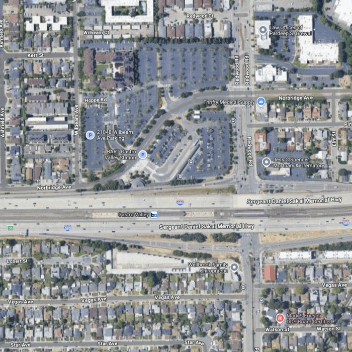
A transit planner in a suburban agency asks an eternal question:

Do you have any examples of best practices in transit service in large business parks?  I am looking for some creative solution, such as a transit to vanpool connection, or a site redesign for accessibility.

If you have an opportunity, please share some examples, thoughts, etc.…

Continue Reading →

Houston’s reimagined network: don’t let us make it look easy!

AnimatedFrequentNetwork

It's great to see the national press about the Houston METRO System Reimagining, a transformative bus network redesign that will newly connect a million people to a million jobs with service running every 15 minutes all day, with almost no increase in operating cost.  Last week, when the Houston METRO Board finally adopted the plan for implementation this August, I was in New Zealand advising Auckland Transport executives on how to roll out a similar plan there, one that MRCagney and I sketched for them back in 2012.  Advising on these kinds of transformations, and often facilitating the design process, is now one of the core parts of my practice.

And here is my most important piece of advice:  Don't let anyone tell you this is easy.

Much of the press about the project is picking up the idea, from my previous post on the subject, that we redesigned Houston's network to create vastly more mobility without increasing operating cost — "without spending a dime," as Matt Yglesias's Vox piece today says.   An unfortunate subtext of this headline could be:  "Sheesh, if it's that easy, why didn't they do it years ago, and why isn't everyone doing it?"

Some cities, like Portland and Vancouver, "did it" long ago.  But for those cities that haven't, the other answer is this:  

Money isn't the only currency.   Pain is another.  These no-new-resources restructurings always involve cutting some low-ridership services to add higher-ridership ones, and these can be incredibly painful decisions for boards, civic leaders, and transit managements.  Civic officials can come out looking better at the ends of these processes, because the result is a transit system that spends resources efficiently in a way that reflects the community's values.   But during the process they have every reason to be horrified at the hostility and negative media they face.

If you're on a transit board, here's what these transformations mean:  Beautiful, sympathetic, earnest people — and large crowds of their friends and associates — are going to stand before you in public meetings and tell you that you are destroying their lives.  Some of them will be exaggerating, but some of them will be right.  So do you retain low-ridership services in response to their stories, and if so, where does that stop?  I'm glad I only have to ask these questions in my work, not answer them.

For a decade now I've been helping transit agencies think through how much of their service they want to devote to the goal of ridership and how much they want to devote to a competing goal that I call coverage.  Ridership service should be judged on its ridership, but coverage service exists to be available.  Coverage service is justified partly by the political need for everyone (every council district, member city or whatever) to have a little service, because "they pay taxes too," even if their ridership is poor.  But it's also justified as a lifeline, by the severity with which small numbers of people need it.  

In the early stages of the Reimagining project, I facilitated a series of METRO Board and stakeholder conversations about the question:  How much of your operating budget do you want to spend pursuing ridership?  I estimated that only about 55-60% of existing service was where it would be if ridership were the only goal, so it wasn't surprising that the agency's ridership was stagnant.  I explained that the way you increase ridership is to increase the percentage of your budget that's aimed at that goal.  And if you're not expanding the total budget, that means cutting coverage service — low ridership service, but service that's absolutely essential to some people's lives.  

In response to a series of scenarios, the Board told us to design a scenario where 80% of the budget would be devoted to ridership.  That meant, of course, that in a plan with no new resources, we'd have to cut low-ridership coverage service by around 50%.  Mostly we did that not by abandoning people but certainly by inconveniencing some of them.  But there was no getting around the fact that some areas — areas that are just geometrically unsuited to high-ridership transit — were going to be losers.

We didn't sugarcoat that.  I always emphasize, from the start of each project, how politically painful coverage cuts will be.  The stakeholder committee for the project actually had to do an exercise that quantified the shift of resources from low-ridership areas to high-ridership ones — which was also a matter of shifting from depopulating neighborhoods to growing ones.  They and the Board could see on the map exactly where the impacted people were.

And exactly as everyone predicted, when the plan went public, those people were furious.  Beyond furious.  There really isn't a word for some of the feelings that came out.

Houston had it much worse than most cities, for some local reasons.  Along the northeast edge of inner Houston, for example, are some neighborhoods where the population has been shrinking for years.   They aren't like the typical abandoned American inner cities of the late 20th century, where at least there is still a good street grid that can be rebuilt upon.  In the northeast we were looking at essentially rural infrastructure, with no sidewalks and often not even a safe place to walk or stand by the road.  Many homes are isolated in maze-like subdivisions that take a long time for a bus, or pedestrian, to get into and out of.  And as the population is falling, the area is becoming more rural every year.

I feel the rage of anyone who is trapped in these inaccessible places without a car.   I also share their desire to love where they live, and hope my description hasn't offended them.  But I can't change the geometric facts that make high-ridership transit impossible there, nor can I change the reality of their declining population.  And that means I can't protect civic leaders, elected officials, and transit managements from the consequences of any decision to increase the focus on ridership.  Increasing your transit agency's focus on ridership, without growing your budget, means facing rage from people in low-ridership areas, who will continue to be part of your community.

Houston's situation is worse than most; less sprawling cities can generally prevent any part of the city from depopulating in the context of overall growth.  But in any city there are going to be less fortunate areas, and the disastrous trend called the "suburbanization of poverty" means that increasing numbers of vulnerable people are forced to live in places that are geometrically hostile to high-ridership transit, and thus demand low-ridership coverage service.

So don't let anyone say this was easy.  What's more, in Houston it was easier for me than for anyone else involved, which is why I'm uncomfortable when Twitterers give me too much credit.  I flew in from afar, facilitated key workshops for the Board and stakeholders, led the core network design process, and got to go home.   It was the the Board, the management, the key stakeholders and the local consultants led by TEI who had to face the anger and try to find ways to ease the hurting.  

Was it worthwhile?  I was very touched by what METRO's head of planning, Kurt Luhrsen, wrote after the Board's decision.

I am overjoyed for the citizens of Houston.  Particularly those who are dependent upon the bus and have been riding METRO for years.  Their trips to the grocery store, the doctor’s offices, work, school, church, etc. take way too long and are usually way more complicated than they need to be.  

Today, with this Board vote, Houston took a giant step toward making these citizens’ lives better.  That simple fact, making people’s lives better, is why I love my job in transit.  It is where I draw my inspiration and today definitely recharged my batteries a bit.  I am also very proud of our Board, METRO employees, our consultants, our regional stakeholders and many others who worked tirelessly to make this action today possible.  These types of projects are difficult, that’s why so few transit agencies really want to do them.  But today we did it.  This plan will improve people’s lives, and I am so thankful that I got to play even a small role in it.     

I, too, am thankful for my small role in guiding the policy and design phases of the process.  I listed, here, some of the key people who really drove the process, all of whom worked much harder than I, and who faced much more ferocious public feedback than I did, to bring the plan to success. 

Transit in Houston is about to become a completely different thing, vastly more useful to vastly more people's lives.  But don't let anyone imply this was easy.  It was brutally hard, especially for the Board and staff.  Nobody would have done it if it didn't have to be done.

the pedestrian experience in cities where cars rule

This image by Claes Tingvall needs to go viral.

B46GBihIYAAutQw

I had many years living as a pedestrian in cities designed or managed for cars, including most big American cities in the least century, and I've never seen an image that better captured how that felt. 

The bottomless void, in this metaphor, represents the essential unpredictability of the reckless or distracted motorist (there only needs to be one) combined with the destructive potential of their machine. The sidewalk is a narrow ledge on the edge of extreme danger.  Crossing the street, even with a crosswalk, works when it works, but the rickety bridge perfectly captures the inherent risk; you're still relying on people to notice you even while they're texting, reading the newspaper, daydreaming, dozing off, flipping dials on the radio, trying to figure out the controls on their rental car, or doing any of other the things people do to handle the tedium of driving.

When we face this kind of danger in national parks, the government provides safety railings to keep us back from the precipice.  We tolerate this level of danger only for well-warned hikers in deep wilderness, and for almost everyone who ventures into the city without a car.