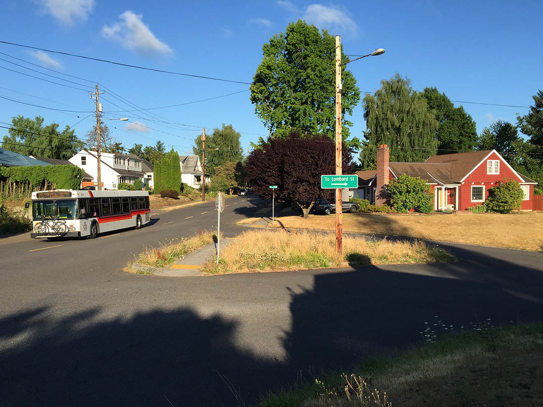
Portland

Is Infrastructure Still about “Awe”?

Allison Arieff in the New York Times thinks the problem with our infrastructure planning is lack of “awe”:

[Dave] Eggers’s proclamation that the Golden Gate [Bridge] is beloved because it’s outrageous and weird may fly in the face of just about everyone’s attitude about infrastructure, but it also gets at exactly what we should be feeling about bridges and tunnels.

Awe.

American infrastructure is deferred home maintenance on a massive scale. We just keep putting it off until something major — and often catastrophic — happens, and then it ends up costing twice as much as it would have had we taken care of it proactively. This is a bad strategy — yet it’s the strategy that seems to define United States infrastructure.

There is no awe. There are issues of structural integrity. There are mind-blowing cost overruns. Accidents. Sinkholes. Problems with bolts.

The first design proposed for the Golden Gate was, writes Eggers, “the strangest, most awkward and plain old ugly bridge anyone had every seen … people compared it to an upside-down rat trap.” (Here is what it looked like.) The public demanded something better — and they got it.

A century later, we’ve lost our collective faith in the power of great projects like the Golden Gate, not to mention our trust in the government to fix a pothole on time and on budget, let alone create an inspiring bridge. How can we restore that faith in possibility?

I’ve lived in cities with awe-inspiring infrastructure (San Francisco, Sydney, Vancouver, Paris) but now I’m based back in my original hometown, Portland.  And Portland is the perfect riposte to Arieff’s obsession with awe.

Portland is “awesome” but not the least bit awe-inspiring.  If you want to gape at the spiritual grandeur of human works, strike us off your list.   Our monuments, bridges, and major buildings are all modest and even gentle.  Many are beautiful but none are magnificent.  Our city is so human-scale that we just don’t need to build very big things.  For some related reason, we also have no need for a dramatic, soaring tower with a rotating restaurant and observation deck.

We don’t need the tower, because we have hills and mountains.  Portland manifests a particular reaction to a natural setting: not the desire to compete with it by creating infrastructure of comparable grandeur, but a humility toward it, a happiness that comes from dwelling in its shadow, and letting it give us all the awe we may need.

Nature now awes us in another respect: We’ve been warned to expect an appalling earthquake in which thousands of us would probably die, because our infrastructure isn’t designed to survive it.  Of our 12 river bridges, for example, only the newest one is pretty assured of not collapsing (a second is now under construction.)  Countless brick and concrete buildings and highway ramps are likely to go.  Arieff dismisses the small mindedness of “problems with bolts,” but bolts are exactly what’s going to kill us.  Telling Portland to spend money on awe instead of bolts could be a pretty direct threat to our lives.

The bigger lesson of Portland is you can build a great city by learning to take pleasure in the actual functioning of things, and the resulting liberty and happiness of people.  Pioneer Courthouse Square, for example, is pleasant but not awe-inspiring, and the real reason to love it is that it’s so massively useful for all kinds of happy and liberating purposes.  In our better moments, we feel that way about our transit system.  Function, especially when it engenders liberty and opportunity as functional transit does, can be a higher delight than awe, and a more durable one.

The other problem with awe is that it’s so often about the power of some people over others.  Versailles and Imperial Vienna are awe-inspiring, but the awe has a purpose: to make you accept your place in a hierarchy of power and privilege.   The medieval cathedral was a gathering place (like our civic squares) and an honest monument to human spirituality, but the awe you feel there is also meant to make you defer to the authority of your local priest and the Pope.   Awe and intimidation are the same thing in slightly different light.

So perhaps we should be suspicious of awe, with its reverberations of power and grandiosity.  Delight and pleasure are are better aesthetic selling points, but at our best, as in Portland in its better moments, even these things arise from functionality, safety, usefulness to vast spectra of people.  And the infrastructure that best does all those things may not be awe-inspiring, in the same way that Portland isn’t.

Let us create affordable and inclusive delight wherever we can find it, but let’s be sure that advocates of function are in the room, reminding us of the urgent human rights and ambitions that only functional infrastructure can support.  Appeals to awe, in particular, are not how we build that room.  Historically, awe’s purpose has mostly been the opposite: to keep people outside, mouths agape at the magnificence, while their betters plan their destiny.

Portland: New Transit Map Underscores Frequent Network

By Evan Landman

Evan Landman is an associate at my firm, Jarrett Walker & Associates, and serves as a research assistant and ghostwriter on this blog. He tweets on transit and other Portland topics at @evanlandman

For years on this blog and in our projects, we've stressed the importance of highlighting and emphasizing transit agencies' Frequent Networks on customer information of all kinds.  Portland's agency TriMet has traditionally been a best practice example here, given their extensive Frequent Network branding down to the individual stop level, but curiously, their system map has not embraced this idea so wholeheartedly. Today, TriMet's new system map changes that, introducing a cleaner, more readable map, which does a much better job of highlighting the agency's premier bus services. 

Let's compare the two, starting with the old map that has just been retired:

Screen Shot 2015-09-30 at 3.57.57 PM

Portland Central Eastside, TriMet map (early 2015)

This Southeast Portland shows the core of the city's Frequent Network. The Frequent Network is symbolized with a thicker line weight, but every line still has its own individual color, presumably to make it easier to trace each individual line across the network. However, the effect of this choice distracts from the important information contained in the line weight property, because the wide diversity of bright colors climbs to the top of the visual hierarchy, though the colors communicate nothing about the nature of the service on each line. 

The legibility of the map is not aided by the large number of points of interest shown, with both text and symbols frequent overlapping the most important features (the transit routes). TriMet's old map was certainly not a bad transit map by any means, and deserves enormous credit for being one of the first to explicitly show frequency at all, but in the years since, many of TriMet's peer agencies around the country have focused even more heavily on frequency to produce truly useful and innovative maps.

Now compare the image above with the same area of the new map:

Screen Shot 2015-09-30 at 3.57.38 PM

Portland Central Eastside, TriMet map (late 2015)
 
This is a map that truly focuses on communicating the usefulness of the transit routes. The most important factor for usefulness is frequency, which is obscured when every line on the map is the same color, or a different color, or colored by a less important attribute, like which corner of the city it serves. 
 
Here, weight and color are both deployed to differentiate the Frequent Network (heavy, dark blue) from other less frequent routes, but without the riot of color of the older map. When we compare the legends of each, the difference is subtle, but the when deployed on the map, the difference is dramatic.
TriMet Map ComparisonThis new map makes one thing very apparent: anywhere near a thick, dark blue line, a bus is always coming soon.
 
It is also a clearer, more traceable map! Where the old version employed the common convention of using color to distinguish routes and make it easy to tell where they travel across the city, the new map uses line displacement and simplification in a much more sophisticated manner to accomplish the same task.
 
For example, examine the path of the 10-Harold: on the old map, its line appears to end at Hawthorne and 12th, where it joins the 14-Hawthorne to head into downtown (it's actually beneath the 14's line, if you look closely). With the new map, it is much clearer that this route overlaps with the 14 in this segment, just by the way in which the two lines have been separated from one another. Now that color is now longer necessary to distinguish each route, it can be used for a more important purpose: showing frequency.
 
Apart from the increased focus on frequency, this map also succeeds by reducing the amount of non-transit information, with fewer points of interest labeled. Those that are present have symbols and labels drawn with a brown color much closer to that of the map's background, reducing the effect of collisions with transit features, and diminishing the level of visual "noise" competing with the transit network structure for the reader's attention.
 
It's fantastic to see an agency like TriMet continuing to work to improve its customer information. Even in the age of real-time data and mobile trip planning, a transit agency's map is often the only place where the entire system is documented in a way that an average person can understand. City transit networks are complex, and the best maps, like TriMet's, are designed to reduce that complexity, focusing on the most important aspects of the service for the people who ride it. 
 

One of my most fun presentations ever …

… especially if you're into architecture, urbanism, philosophy, or literature.  

It's from a keynote to the Oregon Transportation Summit, sponsored by TREC at Portland State University last year.  There are a few local Portland geography references, but nothing you can't follow …  Great questions too. 

I'm introduced at 10:34 by Professor Jennifer Dill, and I start speaking at 11:35

Maybe I was so "switched on" because it was so good to be at home in Portland.  That happens when you travel as much as I do …

Portland: Frequent Bus Performance Approaching Light Rail’s

Here's an interesting chart:

Tri Met Ops Cost per Ride

This is a year's trend comparing bus and light rail (MAX) service in Portland's transit agency, TriMet, from the performance dashboard at the TriMet Transparency and Accountability Center webpage.  

The metric here is operating cost per boarding ride.  This is a good overall measure of how effectively a transit agency is liberating and moving people, where down means good.  (I prefer this ratio upside down: ridership per unit cost or "bang for buck," so that up means good. but this is obviously a chart by finance people who always want cost on top.)  This is a "macro" metric.  Practically everything a transit agency does affects it, so it's lousy diagnosis but not bad if you only have bandwidth to convey one measure.

Most American transit data just compares bus and rail, and inevitably shows bus performing worse.  You'll see that here too if you just look at the wide solid lines.  From this we get endless ignorant journalism lamenting the poor performance of the city bus, as though all city buses are basically alike.

What if we separated out highly useful and liberating bus service as a separate category?  That isn't exactly the distinction made here but it's close.  TriMet's Frequent Service network (still being restored, but mostly now back in existence) is the network of all services that are almost always coming soon.  

This chart says two remarkable things:

  • Frequent bus performance is now very close to light rail performance.   
  • The spread between Frequent Bus and infrequent bus is usually bigger than the spread between all buses and light rail.

The lesson is pretty clear:  The "city bus" is a misleading category, and the much-fetishized difference between bus and rail may matter less than whether the services are designed to be useful.  And when it comes to usefulness, no one variable capture that more than frequency.  

portland: the high-frequency grid is back!

FrequentserviceThe reputation of Portland as a transit city in the last two decades may have been about its light rail, streetcar, or aerial tram, but to the extent that the city achieved significant ridership and made transit a welcomed part of urban life, it's done so with a grid of frequent transit services.  


This grid consisted of both rail and bus services, but it's the frequent grid pattern, not the technology, that made it easy to get around the city, in ways you could measure with trip planning software.  For example, the amount of the city you can get to quickly from the inner-city Hollywood district arises mostly from frequent grid connections , as from the light rail line there. 

Portland_isochrone_intown

[Graphic by Conveyal showing travel times on transit+walking from Hollywood light rail station.  Blue is 15 min, green is 30, pink is 45.]

Back in 2012, this post celebrating the 30th birthday of the high-frequency grid ended with a serious caveat:

Purists might argue that the grid never made it to its 30th birthday, but rather perished at  age 27 in 2009.  That was the year that TriMet cut all-day frequencies below the 15-minute threshhold that is widely accepted as the definition of "frequent enough that you can use it spontaneously, without building your life around the timetable."  Since the grid relies on easy connections to achieve its goal of easy anywhere-to-anywhere access, the 2009 cuts began to undermine the whole idea of the grid. TriMet avoided doing this in its first round of cutting after the crash, but felt it had no alternative in the second 2009 round.  

Will the grid ever be restored to its necessary frequency?  Will it ever be expanded and enriched (as regional land use planning generally assumes it must be) with even better frequencies?  Not everyone in Portland thinks this is a priority, so you might want to express your view.  

Earlier this month, TriMet answered that question by restoring 15 minute service to 10 critical bus routes, in addition to the two routes which maintained that standard through the recession and recovery. During the period of this service cut, as good connections enabled by the frequent grid became more arduous and wait times increased, the overall utility of the system across its strongest market was diminished. The impact on ridership was clear: between fall 2012 and fall 2013 alone, weekday bus ridership declined 3.6 percent, 2.6 on the MAX light rail system, continuing the negative trend starting from 2009.  

The return of the grid is good news for riders, and no doubt the agency hopes to reverse the troubling ridership trend and create some good publicity in the processs. High frequency transit service is a key characteristic of many of Portland's most attractive neighborhoods, and must be seen as a permanent element of these places if they are to continue to grow in a manner that enables people to make real choices about their travel options. 

More importantly, the return of the grid is good for anyone who wants Portland to be a denser, more walkable, more sustainable city.  Portland policy allows lower minimum parking requirements for dense housing located along the frequent network, and those low requirements help make such development viable as an alternative to sprawl.  Last year, though, there was an eruption of controversy around these requirements in one inner neighborhood, and one of the legitimate objections was that the full span of frequency (7 days including evenings, as you need for a liberated life on transit) had been cut in 2009.  

The fall and rise of Portland's frequent grid shows the perils to actual freedom of access that arise when buses aren't respected for their essential role, and when nobody steps up in an economic crisis to save a crucial building block of the city's redevelopment policy.  Portland's 2009 frequency cuts drove away a lot of transit riders.  Please spread the word that they are welcome back.

job: part time entry level transit analyst at our firm

JWlogoSquare
Our firm is growing in Portland and we'll soon be adding another entry level person with good geographic and spatial analysis skills, and strong GIS experience.

This job starts as a subcontractor as we find out if we're a good fit for each other, but then could quickly turn into employment.  For that reason, it's probably for someone who's already in Portland, though I certainly won't tell you not to move here.  

Download the details here:   Download JWA Jr. Associate GIS Analyst

Please spread the word!

portland: the citizens’ priorities for transportation

If you respect Portland as a leader when it comes to transit and sustainable urbanism, you should be interested in what its citizens think, not just what its spokespeople and marketers say.  It's the citizens who've demanded most of Portland's most dramatic transformations, and they who have to signal when it's time to take the next step.  

So here's what citizens of Portland think about how the city should prioritize its transportation investments, from a statistically valid phone survey (cellphones included) with a margin of error just under 5%.  

Screen Shot 2014-02-18 at 2.00.18 PM

Possible investments were ranked on a 1-7 scale where 7 (counter-intuitively) means the highest priority and 1 the lowest.  Dark green on this chart means users chose 7, the highest priority, while light green means 6, blue means 5 etc.   The brown is 4, which means netural, and the red and gray colors  at the right are low priorities.  Click to enlarge and sharpen.  Original report is here and PowerPoint here.

Frequent bus service (slashed in 2009 with major ridership losses resulting) is the top transit service priority, closely followed by more (probably more frequent*) light rail service.   Streetcars, in this supposed national leader of streetcar-revival movement?  Not so much.

Responses to frequent bus and MAX service may be lower than actual because some respondents could have presumed that the survey was solely about things that the City of Portland controls, and transit supply isn't one of them.

On the other hand, there's not much patience for parochialism on the part of Portland's city government.  

Screen Shot 2014-02-18 at 2.00.08 PM

People are increasingly seeing the services of regional agencies as something that the City of Portland may need to act on.  Given the list of improvements discussed above, and their relative importance, this response is probably heavily about Portland's relationship to TriMet, the regional agency that controls transit service. (It may also be about the relationship to Oregon's DOT, which still controls some major arterials.)

So for example, it's plausible that transit advocates who are in the 20% that oppose city involvement in "things it doesn't own" would not mention bus and light rail service as City of Portland priorities, even though they support them as investment priorities in general.  Support for these things may thus be even higher than indicated.

So to sum up (and some of this will be more surprising to Portland-admirers than to Portlanders):  

  • Less than 40% of Portlanders would assign any priority to expanding the streetcar system further, and only 9% call it a top priority.  
  • By contrast, two thirds (67%) assign a priority to frequent bus service, and 23% call it a top priority.
  • In a separate question, over 70% of respondents said they'd be "more likely" to support a "funding package that improved bus service in areas with substandard service, particularly if the areas are low income." 
  • Most important: more than 3/4 would say that just because the city doesn't control the transit agency doesn't mean that it shouldn't invest in the service that's needed, or lead in funding that investment.

This is actually a very practical view, the only one that ultimately works with transit's underlying math.  Core cities have higher per capita transit demands than their suburbs [see Chapter 10 of my book Human Transit] so they always tend to be underserved — relative to demand — by regional transit agencies that aim for some concept of "regional equity."  In many cases, the only solution is for core city voters to step up and vote, for themselves, the additional service that only they know that they need.  This doesn't have to mean breaking up the regional agency, but it does mean giving up on the idea that any service distribution formula that a suburb-dominated region would agree on will meet the core city's expectations for transit, based on the core city's economy and values.  

Am I concerned about the low ranking of bus lanes?  Not really surprised.  We would have to get our frequency back (many major Portland bus lines run less frequently than they did in 1982) and put ridership growth back on track.  Then that question would naturally arise in its own time.

There are other interesting nuggets in this survey.  Portlanders' overwhelming obession with pedestrian safety is heartening, especially since this is a crucial transit improvement.  (This may also signal a shared concern for East Portland, the disadvantaged "inner ring suburbia" within city limits that has poor pedestrian infrastructure, inadequate transit frequency, and most of the city's pedestrian fatalities.)  Portland cycling advocates, and their national admirers, may be disappointed in the ranking of "safe bike routes."  Sadly, cycling is polarizing here as it is everywhere.  Although 55% give some priority to "safer bike routes" and cycling is the only mode whose share of work trips is clearly growing, opposition and disinterest are also higher on cycling than for the main transit service investments.   

But when it comes to transit, there are some clear signals here, not just for Portland but for any city that hopes to replicate its achievements.


*This question should have been more specific.  The response says "MAX light rail service" which could mean either geographic expansion or more frequency.  The frequencies on MAX have been cut substantially in the last five years, so at least some of this response is probably about frequency.

quote of the week: the decline of local journalism

From a midwestern newspaper journalist's anonymous email to Andrew Sullivan:

When you see the metrics every day, and it’s clear that quick-hit crime stories or freak-show stories generate as many clicks as an investigative piece that took weeks to report, what rationale can there possibly be for doing the investigative work, the longer-form stories that actually help explain the workings of a community to the people who live there?

If you care about the quality of journalism, consider a policy of refusing to click on crime and freak-show news, no matter how much the headline arouses your curiosity.  One advantage of online journalism is that when I refuse to click on those stories, that disinterest is recorded.   Obviously I'm in the minority, but the conscious behavior of consumers is the only thing that moves corporations.  

Portland Mayor Charlie Hales recently said that one of his biggest problems as mayor is the lack of credible local journalism, which has made it impossible to have a public conversation about issues that matter to the city and region.   Would the great achievements of consensus in the past have been possible without our newspaper of record, the Oregonian, as a universally recognized forum for discsussing the issues of the day? 

It's not just that the Oregonian has ceased to publish on paper, it's also that its website looks trashy and conveys the company's low self-esteem.  Big O, before your name is utterly forgotten, wake up and realize that your marketing advisors are killing you.  Fire whoever suggested that your website be called "Oregon Live" instead of "The Oregonian," and that it should look like the website of a cheap fly-by-night aggregator instead of like that of a newspaper.  The credibility that comes from a long and respected history is the only thing legacy newspapers have as a competitive advantage, and the Oregonian is throwing that away.  

When you really start thinking about this, it's hard to face how scary it could be.  Sure, there are other ways of getting news, usually news pre-digested for those who share your political views.   But there's no other way for the whole city to have a conversation.  How can we do planning without that?

a glimpse into the road lobby’s echo chamber, and how to respond

Canada's leading newspaper has published an anti-transit rant, by Brian Lee Crowley of the "non-partisan" MacDonald-Laurier Institute.  It's based on the work of the Texas Transportation Institute, a leading source of studies that view cities from behind the wheel of a single-occupant car.  It's filtered via Wendell Cox, who's made a career of car-centered advocacy.

I analyzed TTI's work more patiently here, so I'll cut to the chase now.  TTI believes that traffic congestion is a valid measure of people's ability to access the resources of their city.  They do not measure actual travel times for all people, or the liberty and economic opportunity that a good urban transporation system offers.  They apply these things as factors to a degree, but their bottom line is road congestion.  

Specifically, their metric is the difference in travel times, by car, between travel time on congested roads and the same roads in a free-flow condition.   In other words, their baseline utopian condition is abundant free-flowing roads at all times of day.  (That condition is actually an economic impossibility in a city above a certain size with a healthy economy and no road pricing.)  

Once you insist on measuring congestion, and against that fantasy baseline, you can get absolutely everything backwards.  

Portland, Ore., has pursued road-skeptical policies similar to many major Canadian cities. The result is markedly worsened commuting times. According to the TTI, over the past 30 years Portland has gone from having the 47th worst congestion in the U.S. to the sixth worst.

"Markedly worse commuting times" is false.  If you count everybody's commuting time, Portland is ahead of most US metros.   As the next sentence reveals, it is only congestion that is worse.  Yes, like all dense cities, Portland has exactly as much congestion as it makes room for, but it has low overall commute times, mostly because its carefully mixed density allows many people to commute very short distances.   Remember, if you are measuring car congestion, Portland's transit riders and cyclists and the many people who can walk to work simply do not exist.  Crowley disses "congested" Vancouver for the same reason, even though Vancouver is the only Canadian metro where the long-term trend is toward shorter commute times, due to continued consolidation of housing and business around transit.  

So how should an activist respond to this kind of talk from the asphalt-and-petroleum echo chamber?

Everyone should know how to respond to articles like this, because we'll keep seeing them.  The comments on the article ("Wendell Cox is an idiot") are not encouraging.  Wendell Cox is not an idiot.  He is part of a reactionary process that accompanies every revolution, one that we'll hear more from.  He's a smart man who knows exactly what he's doing.

Take time to understand the point of view.  Many people's brains are so fused with their cars that to them, congestion really is the same thing as urban mobility or urban liberty.  To them, the TTI is right.  

So first you have to object by shining light on that premise.  TTI, and by extension Canada's leading newspaper, believes that certain people do not exist or do not matter — namely everyone who already travels by transit, bike, or foot,  and everyone who can imagine choosing not to drive in the face of real and attractive choices.  

But then, avoid the trap of casting these excluded people as an underclass.  Too many activists fall into that Marxist reading, and issue a call to arms on  behalf of "ordinary people."  They get through to people who already agree with them, but to the dominant business culture they look like an easily-dismissed-or-manipulated rabble.  Instead, read Edward Glaeser or Bruce Katz and understand that people who are investing in low-car "congested" cities are the leaders of the new information economy.  

A good retort to road-lobby claims that life is really better in Houston than in Vancouver is to check the cost of comparable housing.  If it were has hard to get around in Vancouver as TTI suggests, people wouldn't pay a fortune to live there.  Transit-rich cities are expensive, in part, because many people there can get around without being stuck in congestion.  High costs of living, in turn, are the market telling us to create more places just like that.  This is the free-market argument.  It is the only one that will break through to the business mind and start conveying that maybe there's something to all this transit-oriented investment.  

The TTI will last at least as long as the Tobacco Institute, and it will sound just as scientific in praise of its product-centered world view — in this case, a world in which only motorists count.  So you have to question the world view.  If an argument is based on a false remise, don't engage the argument, because in doing so you're accepting the premise.  Attack the premise.

holiday map immersion

If you're hiding with your laptop in the laundry closet because an ancient family argument has broken out over holiday dinner, it's a great time to geek out on how fast mapping is changing.  Go over to Atlantic Cities and explore Emily Badger's great overview of 10 ways that mapping has evolved over the past year.

My favorite: I usually try to be race-blind in my thinking about transit and cities, but I have to admit I was absorbed by Duncan Cable's Dot Map of Everyone in the US, which is color coded by ethnicity.  Not really everyone: You can't zoom in to find your personal dot, but it's still a magnificent rendering of how dot-crowding conveys density on a map more naturally than shaded zones.  Chicago, for example, displays pie-slices of single-ethnicity neighborhoods (blue is white, red is Asian, green is African-American, orange is Latino/Hispanic), but you can also see where the borders are soft, where they're hard, and where highly mixed areas exist or are emerging:

Chicago racial dot map

Houston, where I'm working now, is also made of pie slices, but the colors are more muted, indicating more mixture almost everywhere.  Near the center of this image, the greater Montrose and Heights districts are rainbow pointillism.  The Asian node in the south is student areas near Texas Medical Center.  

Houston racial dot map

And my home town, Portland, with downtown on the far left (as it is), showing the new concentric-circle pattern, as lower income minorities (because of income, rather than race) are forced to settle on the fringes of the old city (top edge and far right) or what we'd now call "inner ring suburbs."   The bike-and-transit-friendly city you've seen pictures of is mostly white with small dashes of color. The exception is downtown, which still has a mix of housing types tending to both income extremes, and the continuing black presence in the neighborhoods straight north of downtown even as these gentrify.  (As a small child in 1970 I remember seeing a cover of the local free weekly that showed a hand drawn line around this district with the title "Red-lining the Ghetto," about the impossibility of getting loans to buy or improve homes in that area.  Now, it's on fire with higher-end redevelopment.)

Portland racial dot map

Of course these are also fascinating simply as density maps.  Did you know that Oregon cities have had Urban Growth Boundaries since 1972?  The hard edges show around many Oregon cities … Here's the north edge of Portland's western suburbs (the "Silicon Forest"):

Wash co racial dots

For contrast, here's a same-scale image of the north edge of Clark County suburbs, just over the river in Washington:

Clark co racial dots

Washington loses farmland to development much more rapidly than Oregon does.  It makes a difference.  

In the end, what I love most about these maps is that they're beautiful.  As in art, patches of a bright color are beautiful, but so are intense mixtures of color.  So I look at these maps and feel good about both single-ethnic communities and mixed-ethnic communities, and my eye enjoys the patterns of density, hard edges here, soft there, even more.  These maps take an emotive kind of diversity and render it as serene.  The perfect geek-out for serene holidays.